Exploring the Magnificent Omarama Clay Cliffs
Last Updated: 7th October, 2023
Hidden in the heart of the stunning Mackenzie Country in the Canterbury region, and only a short drive from the charming town of Omarama, are the magnificent Omarama Clay Cliffs! These unique rock formations, with their towering, sculpted pinnacles and ridges, are a must-see when travelling the South Island of New Zealand. In this article, I cover all you need to know about visiting the Clay Cliffs of Omarama!
Fun Facts about the Omarama Clay Cliffs!
What are the Omarama Clay Cliffs?
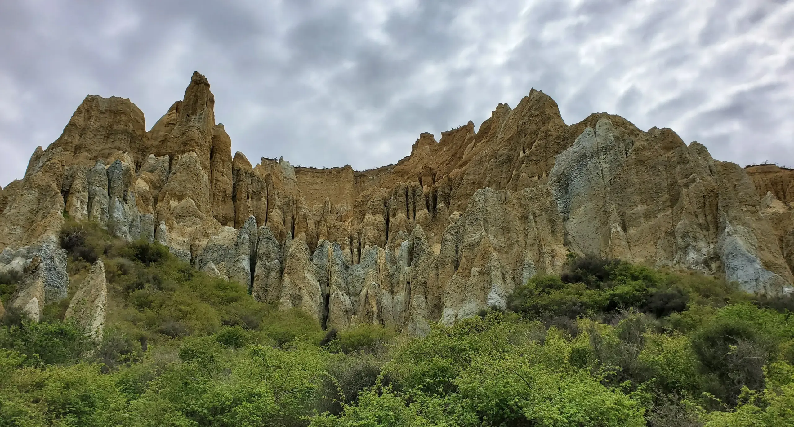
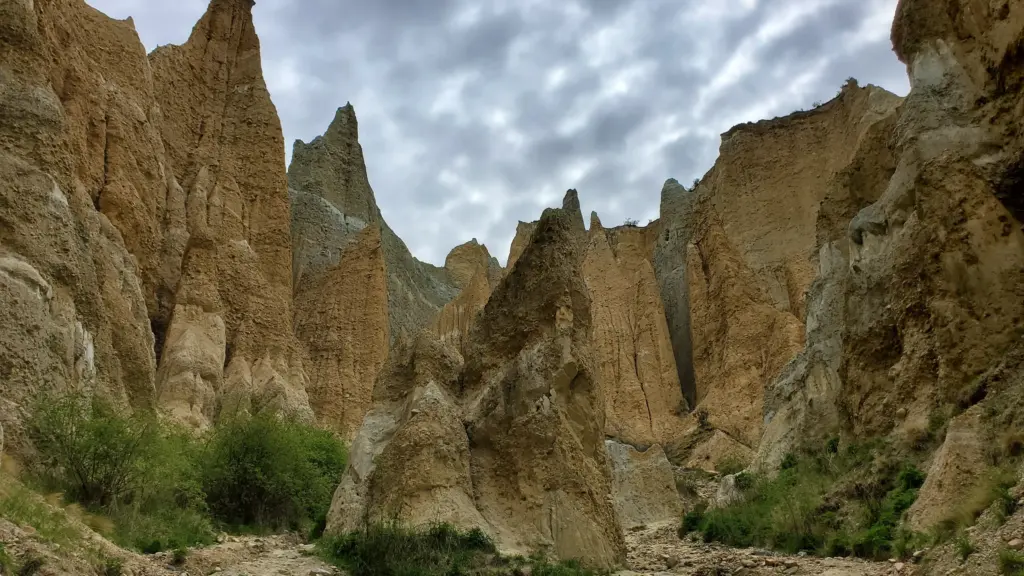
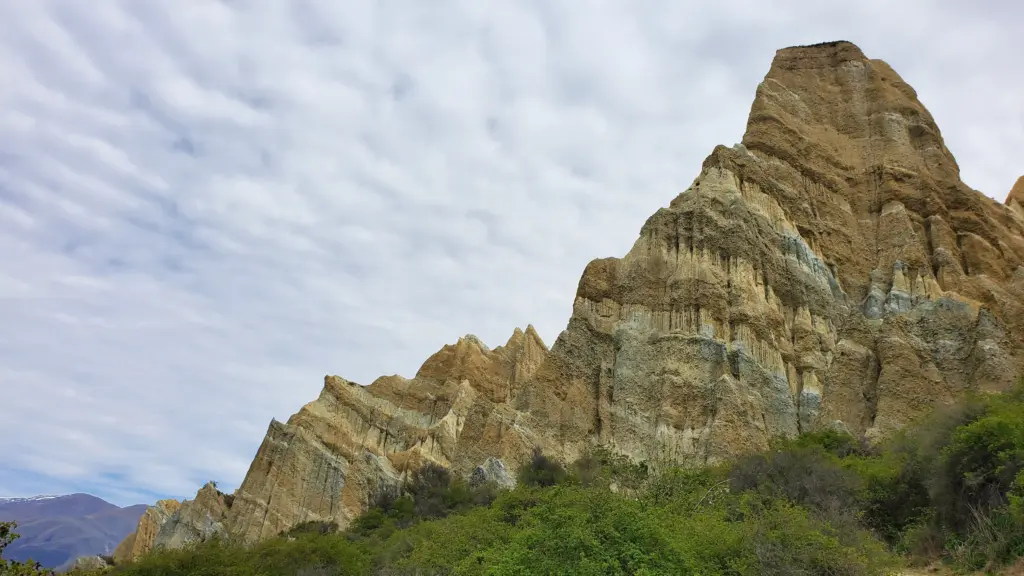
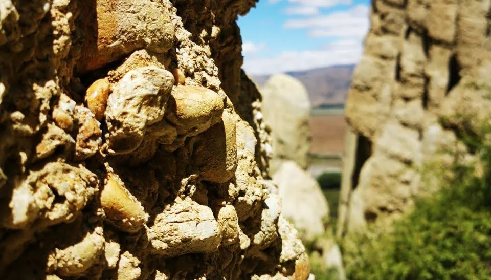
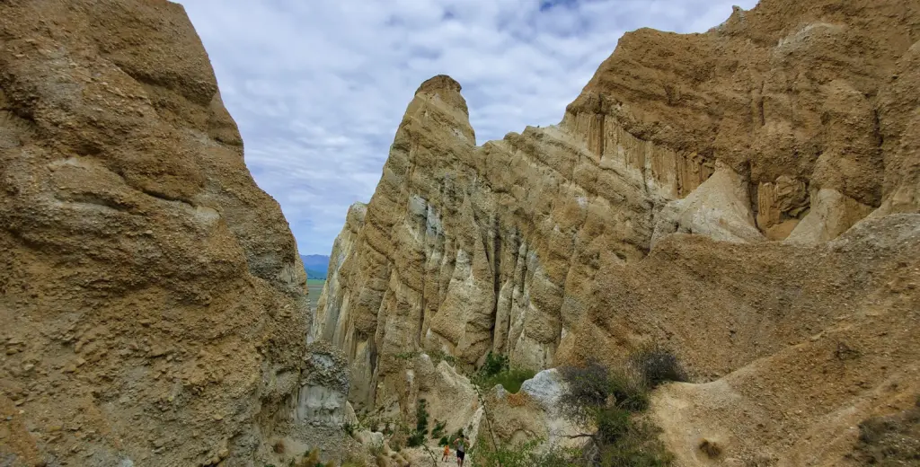
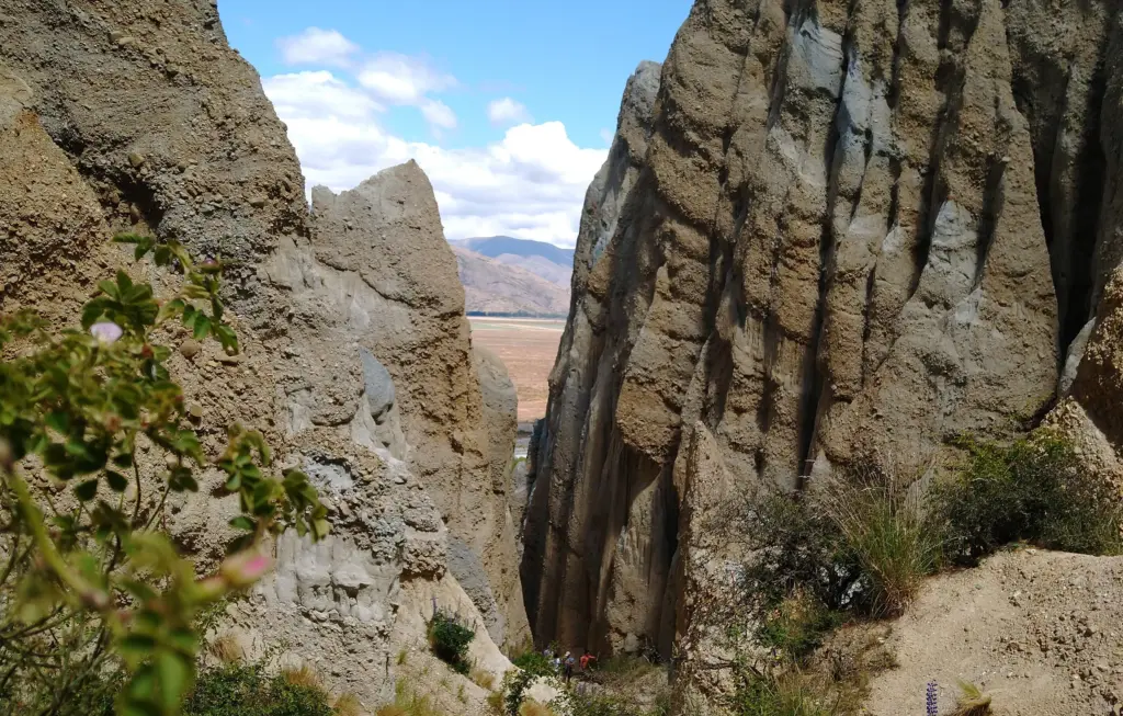
The magnificent Clay Cliffs in Omarama are a natural geological formation, and are pretty much exactly what the name suggests! They are an spectacular sight, with towering, jagged pinnacles and ridges formed mainly of clay, separated by steep and narrow ravines.
How were the Omarama Clay Cliffs formed?
These incredible Clay Cliffs are made up of many layers of gravel and slit, and were originally formed by the flow from ancient glaciers over a million years ago! From then, natural elements such as rainwater and wind have eroded the softer layers of clay and slit, leaving behind the rugged, dramatic landscape you can wander through today.
Where are the Omarama Clay Cliffs?
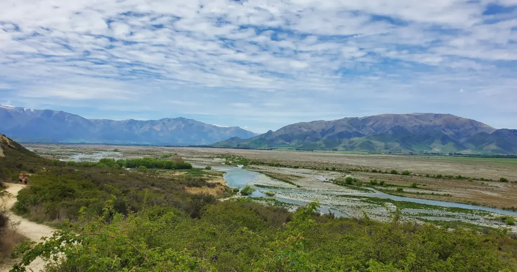
These natural rock formations are around 20 minutes drive (16km) from the charming town of Omarama, in the Canterbury region of the South Island of New Zealand. They are nestled along the beautiful Ahuriri River.
Location: Henburn Road, Omarama
Omarama Clay Cliffs Map
Tips for Visiting the Omarama Clay Cliffs
How to Get to the Clay Cliffs
The Omarama Clay Cliffs are located a little way out of the town of Omarama, off State Highway 8. The turnoff to the Omarama Clay Cliffs is just north of the town (heading towards Lake Pukaki) after the beautiful Ahuriri Bridge over the river.
From here, you will see a turn onto Quailburn Road, which heads west along the Ahuriri River. After a short while, there is a left-hand turn onto Henburn Road, which will take you to the Clay Cliffs! This turnoff is signposted, however it is small and can be easy to miss.
Once you turn onto Henburn Road, the road will change into an unsealed gravel road. This is in good condition, however its important to drive slowly along so you don’t flick up rocks as you go! Follow the road along, and soon you will see a large sign pointing you to the Omarama Clay Cliffs carpark!
Omarama Clay Cliffs Entrance Fee
The Omarama Clay Cliffs are located on private land, and so we are very lucky that we are allowed access to view these incredible rock formations! There is a small maintenance fee of $5 per car, which can be made at an honesty box before you pass a small gate. It’s definitely a good idea to have cash on you for times like this, and is a small cost to help the owners maintain the area and road for future visitors!
The Best Time to Visit the Clay Cliffs
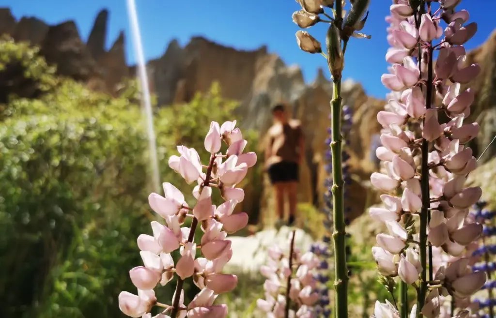
The Omarama Clay Cliffs are open year-round, and are awesome to visit as you are passing through the area. One of my favourite times to visit is during the late spring/ early summer months (November – February), when the beautiful Lupins are flowering and created patches of colour in the landscape!
In winter, the trail may become a bit muddy and slippery after rainfall, and so it’s best to wear some proper hiking shoes are the walk!
The Omarama Clay Cliffs have become quite a popular place for tourists to visit on a South Island Road-trip, and so it can get a bit more crowded in the peak summer months! If you are wanting a more private experience, then I recommend planning your visit early in the day or later in the evening to miss the crowds!
The Omarama Clay Cliffs Walk
Once you reach the Omarama Clay Cliffs carpark, there is a short walking path that wanders through the beautiful landscape until you reach the magnificent Clay Cliffs!
From the car park, the path runs along the outside of the Clay Cliffs, and is surrounded by green bush and colourful lupins. The path is around 500 meters long (one way), and is relatively flat and is in good-condition, making it an easy 20-minute stroll to reach the cliffs.
Note: The path at the Clay Cliffs is rocky and has an uneven surface, and so is unsuitable for people with mobility issues.
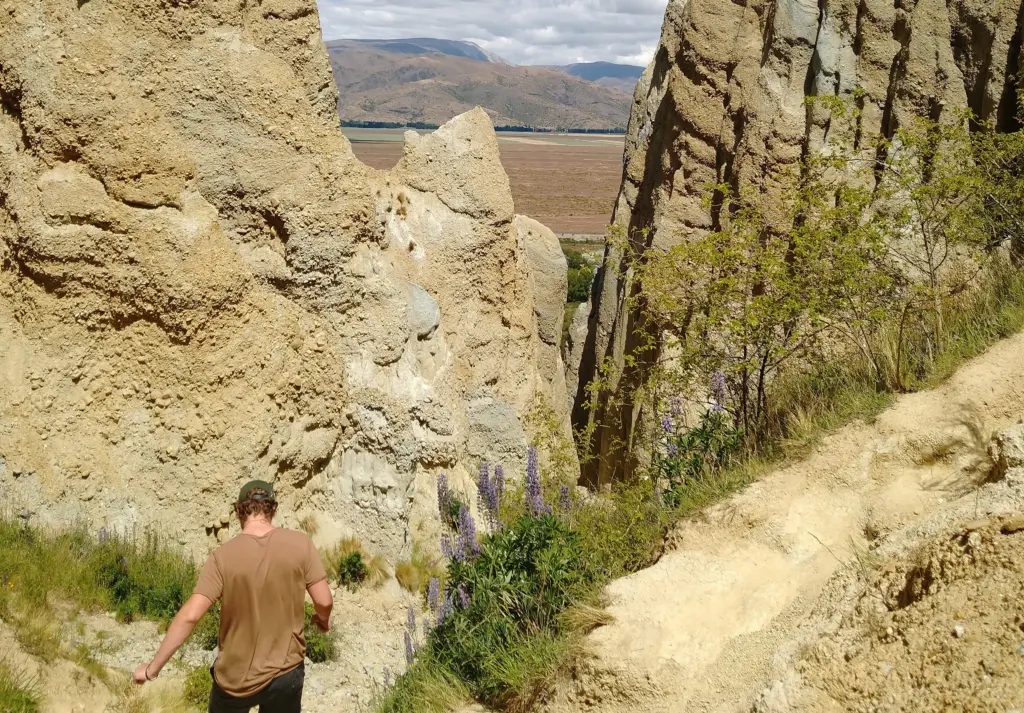
At the end of this path, there is a narrow opening that leads you to a large area where you are completely surrounded by the Clay Cliffs. This is an incredible experience, and so much fun to explore! If you decide to venture into the cliffs, make sure you are wearing some decent shoes, as the path becomes a bit more challenging and steep as you climb into the ravine!
Map of the Omarama Clay Cliffs Walk
Other Things to Do in Omarama, New Zealand
1. Soak in the Omarama Hot Tubs
One of the true hidden gems of the South Island are the incredible Hot Tubs Omarama. These beautiful and sustainable hot tubs offer true luxury and relaxation – perfect after a long drive or an adventure through the Omarama Clay Cliffs!
These hot tubs are absolute bliss, set outside and surrounded with private views over the stunning Mackenzie countryside and surrounding mountain ranges. Each hot tub is completely private, and made from beautiful, locally sourced wood and filled with pure New Zealand mountain water. This is definitely an unforgettable experience in Omarama!
2. Have a Coffee at the Wrinkly Rams
One of my favourite places to stop while driving through Omarama is at The Wrinkly Rams Cafe. This charming and quirky cafe is located just north of the town center, and you can’t miss it as you drive in to Omarama!
This cafe is fantastic, with awesome coffee and delicious homemade food – perfect for a road-trip break! They also have a fantastic gift shop, filled with souvenirs and New Zealand-made products, which I love having a browse through before getting back on the road!
Location: 24-30 Omarama Avenue, Omarama
3. Drive the Stunning Lindis Pass
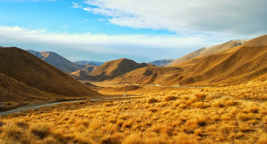
Only a short drive south from Omarama will take you into the heart of the incredible Lindis Pass, a dramatic and beautiful mountain pass that links the towns of Omarama and Cromwell. This is one of my all-time favourite sections of the drive from Lake Tekapo to Queenstown, and we always make sure to stop at the Lindis Pass Summit Lookout to soak up the dramatic scenery.
The Lindis Pass is renowned for it’s breathtaking alpine landscapes and rugged mountains. As you leave Omarama and start heading towards the pass, you’ll be surrounded by rolling hills and vast expanses of golden snow-tussock grasslands. The State Highway 8 winds is way up into the pass, giving you the most spectacular views over the pass and the Southern Alps on the horizon.
4. Pat the Omarama Sheep Statue
In the heart of Omarama is the gorgeous Merino Sheep Momument – a distinctive (and very cute) landmark that pays homage to the significance of merino sheep farming in the region! Merino sheep farming has a rich history in New Zealand, and the fine merino wool is a popular and valuable product.
You can often find warm clothing, beanies, and gloves made from merino wool, perfect for those cold New Zealand winters! If you want to pick yourself up a locally-made item of merino clothing, head to the Wrinkly Ram Cafe (above), which has heaps of beautiful merino-wool clothes and accessories to look through.
5. Enjoy a Walk around Lake Benmore
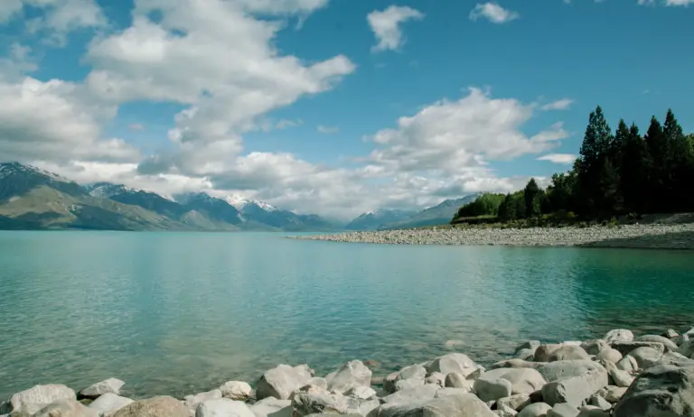
Only a short 25-minute (29km) drive from Omarama is the stunning Lake Benmore – New Zealands largest man-made lake! Surrounded by rolling hills, snow-capped mountains and clear blue waters, this lake is a beautiful hidden gem in the Waitaki District of New Zealand.
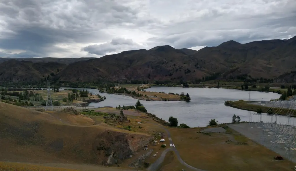
Lake Benmore is the perfect kiwi summer-holiday location, with a number of basic campgrounds and beautiful picnic areas dotted around the lakes edge. There are also some beautiful short walks around the area, giving you incredible views over the lake and the impressive Benmore Hydro Station and Dam!
Benmore Peninsula Walk
- Walking Time: 1 hour 40 minutes
- Track Length: 4km loop
- Track Difficulty: An moderate walking track with some steep sections leading to an incredible lookout!
The Benmore Peninsula Walk is a beautiful (and mildly challenging) loop track, that takes you through lush green bush and to an incredible viewpoint over Lake Benmore!
The walk begins at the carpark at the end of Loch Laird Road, just above the impressive Lake Benmore Hydroelectric Dam! From here, the walk winds it’s way along the peninsula and through vibrant green forest, before climbing up to the ridge-line and the amazing Island’s Lookout.
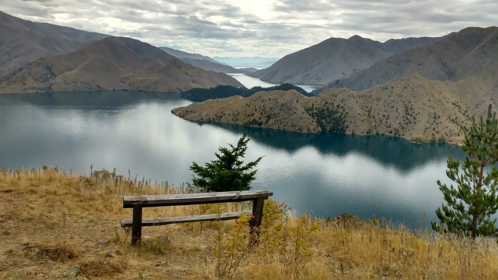
This lookout is definitely worth the climb, with gorgeous panoramic views over the lake and surrounding hills, all the way out to the snowy Southern Alps and (on a clear day) Aoraki Mt Cook! There is a bench at the lookout, so its a great spot to rest and soak up the vista before heading back down to the car park.
Location: Loch Laird Road, Lake Benmore
Thank you for reading my post on exploring the incredible Omarama Clay Cliffs! This was one of my favourite hidden gems in the South Island, and I hope it helps you plan an awesome road trip!
We have been driving through Omarama for years, on family holidays to Lake Benmore or trips into Queenstown, and have always driven past the sign for the Omarama Clay Cliffs. Finally, we had the chance to stop and explore this natural attraction, and I loved it. It is so secluded, and being in the middle of nowhere, we had it almost all to ourselves! It’s definitely my favourite stop on the drive from Lake Tekapo to Queenstown.