6 Days Hiking the Queen Charlotte Track!
Last Updated: 23rd July, 2023
Hiking the Queen Charlotte Track has always been one of my bucket-list items, and in March 2021, I finally got the chance! This hike over the gorgeous Queen Charlotte Sound in Marlborough, located only 30-minutes from the bustling maritime town of Picton, is an amazing way to experience the spectacular scenery of this region! We completed this hike over 6-days, and followed the track from Anakiwa to Ship Cove. In this post, i’m gonna tell you about our experience, enjoy!
If you’re looking for a more detailed post on hiking the Queen Charlotte Track, including accommodation options, transportation, and additional tips and tricks to remember while planning your adventure, check out my post here!
Queen Charlotte Track Map
Our experience hiking the Queen Charlotte Track!
We completed the Queen Charlotte Track in March 2021, which was truly an incredible time to do it. New Zealand was still in lockdown due to covid, and so there were almost no tourists around during this time! This meant that many of the Great Walks, the Queen Charlotte Track included, were incredibly quiet. We decided to walk the Queen Charlotte track from Anakiwa to Ship Cove (northbound) as this was following Timo’s route on the Te Araroa Trail – which runs from Bluff to Cape Reinga! Here is our 6-day itinerary and experiences hiking this gorgeous track!
Day 1: Anakiwa to Davies Bay Campground
- Walking Time: 40 minutes
- Distance: 2.4km
- Trail Description: Easy walk on a well maintained path, relatively flat as it follows the coastline
The start of our hiking along the Queen Charlotte Track! I planned on meeting Timo in Anakiwa, as he was spending the morning walking around the coast from the nearby town of Havelock. After parking in Picton, I wandered down to Picton Marina, where I got on the 1:30pm water taxi that would take me from Picton to Anakiwa Wharf.
As we were starting out later in the day, we decided that our first day’s hike along the track would be a short one – with our destination being the campsite at Davies Bay. This was a short and sweet 1 hour walk along the coastline, following an old bridal path through stunning beech forest. After rounding the headland, you emerge onto the wide, flat beach of Davies Bay, where we set up camp! This campground is very quite, and we were the only ones there! There is a lovely grassy area to pitch your tent, and stunning views over the bay.
Day 2: Davies Bay to Mistletoe Bay Campsite
- Walking Time: 3 hours
- Distance: 10km
- Trail Description: Fairly easy on a well-maintained track, with a steep climb to start the day!
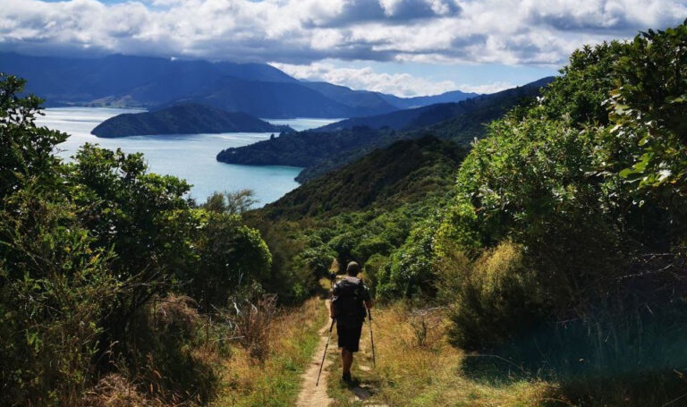
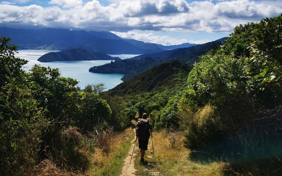
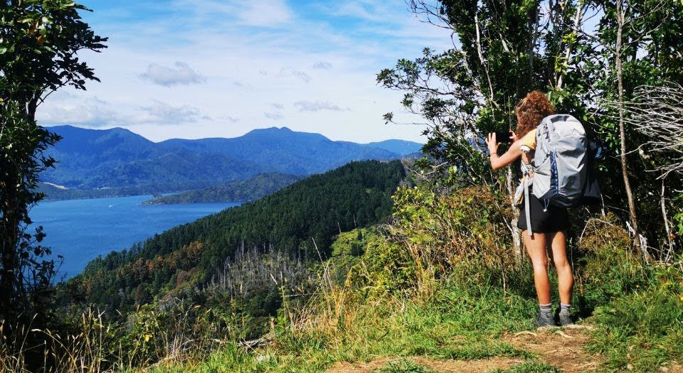
After leaving Davies Bay, the track begins to climb through the stunning beech forest up to the top of the headland. Our first rest stop of the day was at the Grove Arm Lookout, a view point that gives you incredible views over the Queen Charlotte Sound. This was about an hour into the walk, however it was good to have a sit and a snack after the uphill climb!
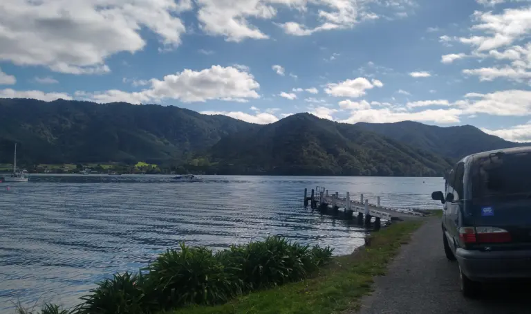
After the view point, the track winds it’s way along the hillside, turning into the side of Onahau Bay. Looking down, we could see a glimpse of Mistletoe Bay, and watch the water taxis as they trundled in and out of the inlet. At the head of the bay you reach Te Mahia Saddle. Here, there are signposts leading to an awesome lookout, where we enjoying incredible views of Kenepuru and the Queen Charlotte Sounds.
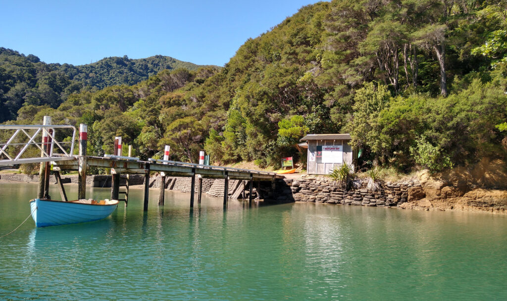
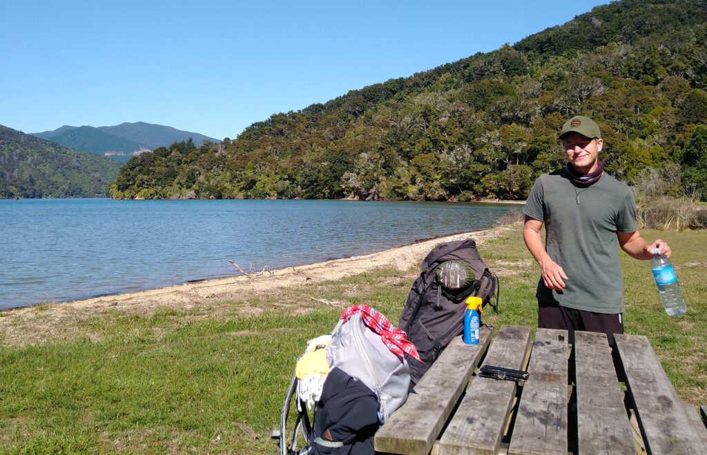
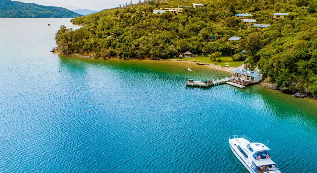
We decided to leave the track and wander down the track into Mistletoe Bay for a afternoon break. The walk down is steep and wide, and finally emerges into the Mistletoe Bay campground. As we arrived, we took one look at the campground and decided to stay the night! With proper showers and toilets, a kitchen, and a wharf to swim off, we decided that it would be a shame not to relax and enjoy this beautiful place!
Day 3: Mistletoe Bay to Nikau Cove
- Walking Time: 4 hours
- Distance: 12.2 km
- Trail Description:
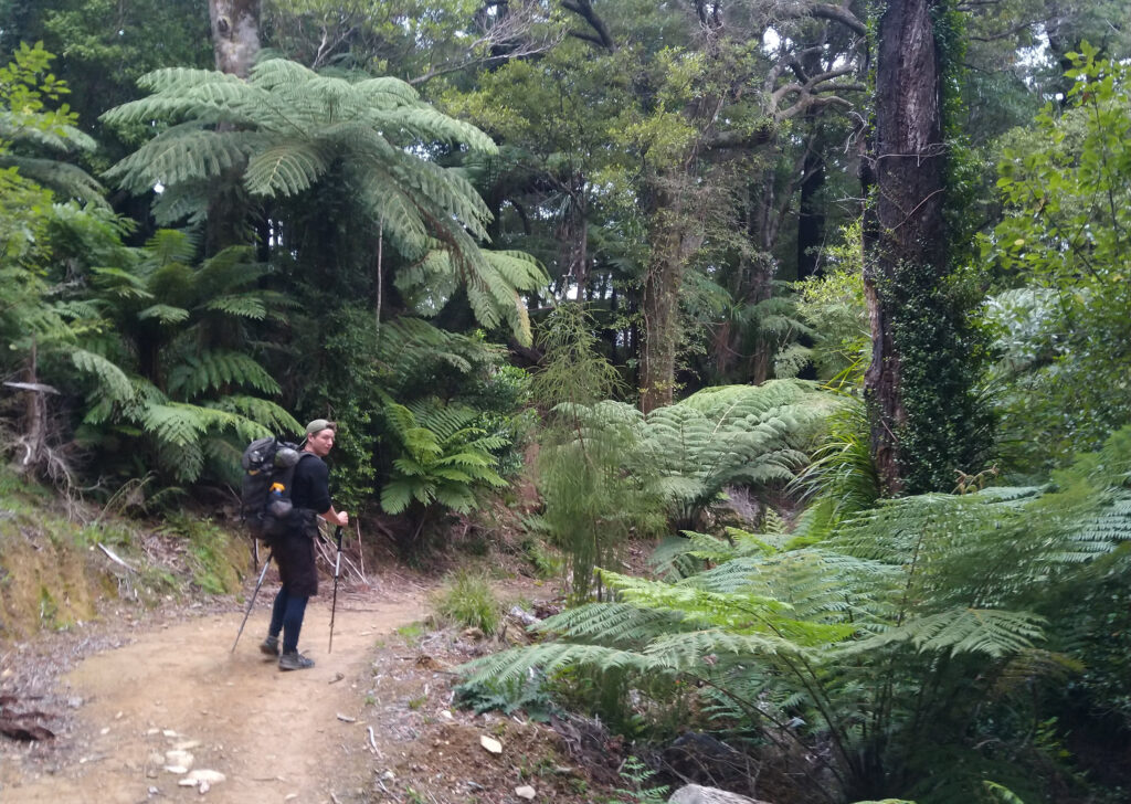
Day 3 of hiking the Queen Charlotte Track started with a short but steep climb from Mistletoe Campground back onto the track! With thighs burning, we turned back onto the well-maintained path through mature beech forest. This part of the journey follows the ridge line, through bright-yellow gorge and native mānuka. The ridge line is undulating, with alternating downhill and unhill sections giving our legs a break!
The scenery along the ridge-line is amazing, with sweeping views overlooking the Kenepuru Sound. We had a quick stop at the Onahau Lookout, which gives you unobstructed views over the sounds, before following the track down to the Torea Bay Saddle. Here, we came across the road that leads down into Portage, and we decided to go down and check it out (possibly to avoid the next uphill to Black Rock campsite!
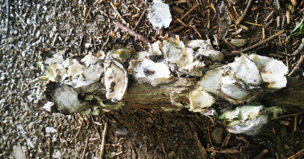
As we were walking the Queen Charlotte Track in off-peak season during the covid-era, almost nothing in Portage was open! We managed to find a cheeky cold beer from the only restaurant open, and then walked down to the beach for a swim and a fish off the wharf. Mooching around the rocks, and what did we find – oysters! Hundreds of them, all over the bay!
It was coming up to evening, and we made the executive decision to abandon the track up to Black Rock campsite, and instead we walked around the road to Nikau Bay Campsite. This campsite was awesome, nestled in the bush along the edges of the bay, and we had the whole place to ourselves!
Day 4: Nikau Cove to Camp Bay
- Walking Time: 5 hours
- Distance: 18 km
- Trail Description: Road walking along the coastline of Kenepuru Sound, with a steep hill climb over Kenepuru Head before coming down into Punga Cove.
Our 4th day of walking the Queen Charlotte Track went a little way off the beaten path! Instead of doubling back into Portage and climbing up to the ridge-line, we decided to continue along the road following the stunning Kenepuru Sound. This road was easy walking and incredibly quite, if a bit winding!
We enjoyed this path immensely, and had a couple of snack stops along the way – one at Sandy Bay, and one at Kenepuru Head campsite. The day was swelteringly hot, so it was nice to be able to take our packs off and dip our feet in the cool waters of the bay. The campsite at Kenepuru also had cold showers available, and I dove right in!
Soon we left the sound behind, and followed the road as it headed towards Kenepuru Head. This section went through farmland, with sheep on all sides, and the occasional farmer on his tractor driving past. Ahead we could see the climb up the headland, with the street zig-zagging it’s way up the side. After a long day of hiking, this was knackering! But when we reached the top and looked down over the stunning Endeavour Inlet, it was all worth it. A small downhill through lush native forest took us down to the Punga Cove Resort, where we stumbled straight into their cute pizza bar on the waterfront. Best way to end a day of hiking!
The Camp Bay Campsite is a few minutes walk along the coast from Punga Cove, and has a large grassy area with heaps of room for us to pitch up our tent for the night.
Day 5: Camp Bay to Resolution Bay
- Walking Time: 6.5 hours
- Distance: 22 km
- Trail Description: Most of this section of hike was easy walking, following the track around Endeavour Inlet. The last few hours take you over a section of headland with a steep climb over Tawa Saddle and down into Resolution Bay.
This was our longest day walking on the Queen Charlotte Track, with over 20km to our planned campground in Resolution Bay. It was also my favourite day of the whole trail, with stunning views over the Endeavor Inlet greeting us as every turn!
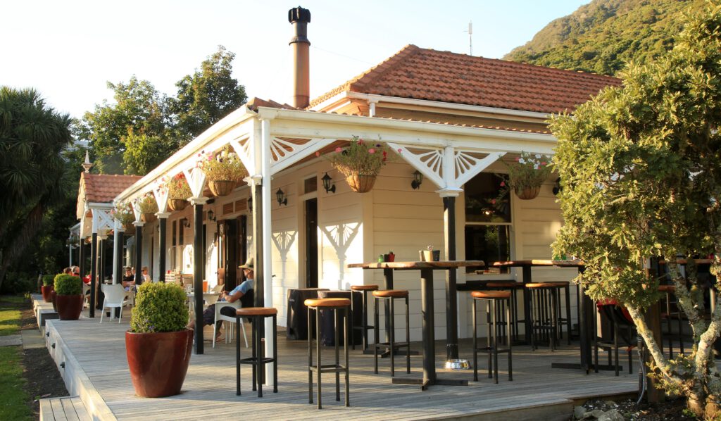
From Punga Cove, the trail wraps around the headland past Big Bay, before dropping into Endeavour Inlet. The water is calm and the views across to the Furneaux Lodge are stunning! The trail sheltered, and winds it’s way through thick native bush and tree ferns until it opens into the grassy lawns of the Lodge on the far side of the Inlet. The Lodge was a great place to stop for our half-way snack break, with stunning views and lots of seating areas around the beautiful cafe.
From the Lodge, the track followed the waters edge until the mouth of the Inlet, where it started a slow and steady climb through regenerating farmland around the Tawa Saddle. We had awesome views down into Resolution Bay – our goal for the night!
Schoolhouse Bay Campground in Resolution Bay was an awesome place to spend the night. Surrounded by lush forest and looking out over the sheltered Bay, we had the whole place entirely to ourselves! Timo went fishing from the rocks, and caught a blue cod to go with our typical rice-and-tuna hiking meal. Take about eating fresh and local!
Day 6: Resolution Bay to Ship Cove
- Walking Time: 2 hours
- Distance: 6.5km
- Trail Description: A slog up the steep hill through thick native forest, with a zig-zag downhill that emerges into the historic Ship Cove. A well-maintained path but it got our hearts pumping!
Our last day on the track was short-but-sweet, as we had a water taxi booked to collect us from Ship Cove at 9am! As we were doing the Queen Charlotte Track northbound (as opposed to the more common southbound), the scheduled water taxi timings were only in the morning. You are also unable to camp at Ship Cove, as it is a protected place of cultural and historical importance. So, a dawn scramble over the final hill it is!
We packed up the tent just as the first rays of light started to streak the sky over the Queen Charlotte Sounds, and begun the trek up through the forest. There is something amazing about hiking in the dark, listening to the incredible dawn chorus of the native birds and watching the sun slowly rise over the sea. It was truly a magical morning, and worth the painful early morning wake up!
We arrived at Ship Cove at just after 8am, and spent a few minutes exploring the area. Ship Cove holds great historical importance as it was Captain James Cook’s favorite anchorage during his voyages to New Zealand in the 1770’s, and there is lots of information about this history here.
Finally, the water taxi arrived, and we begun the 1.5 hour boat ride back to Picton Marina, tired, achy, and incredibly happy. This was a truly awesome hike through some of the most amazing scenery in New Zealand!
Hiking the Queen Charlotte Track on a Budget!
As we have been travelling New Zealand for a while, we were looking hiking the Queen Charlotte Track on a budget! I couldn’t find a good cost list online prior, so I have tried to collate all our costs here for you! These prices are calculated per person.
| Item | Description | Company | Price |
|---|---|---|---|
| Water Taxi | Picton to Anakiwa | Cougar Line | $60 |
| Water Taxi | Ship Cove to Picton | Beachcomber | $76 |
| Campgrounds | 4 DOC campground, plus 1 night at Mistletoe Bay campground | DOC, Mistletoe Eco Village | $58 |
| Multi-day Track Pass | Track Pass for Queen Charlotte Track | QCTLC | $25 |
| Food Budget | Food for 5 days hiking | ~$100 | |
| Total: $319.00 |
To see a complete list of all the campgrounds along the Queen Charlotte Track, check out my notes on this here! 🙂
Thanks for reading about our experiences hiking the Queen Charlotte Track in New Zealand! It was a fantastic experience, and not one i’ll forget anytime soon! If you are looking for other awesome things to do in the region, check out my post on the Best Things to Do in Picton here . Happy hiking!