The Best Walks in Arrowtown, New Zealand
Last Updated: 3rd November, 2023
Arrowtown is a charming, historic township nestled in the heart of the stunning Southern Alps, only a short drive from Queenstown, in the Otago Region. While the town boasts a rich gold-mining heritage and old-world ambiance, it’s surrounding landscapes really steal the show! The best way to explore this beautiful town is to lace up your boots and explore one of Arrowtown’s picturesque walks. From peaceful riverside strolls to invigorating mountain hikes, see the best walks in Arrowtown here!
The Best Walks in Arrowtown, New Zealand
Located only a short drive from Queenstown’s CBD, Arrowtown offers a range of pictureque walking tracks around the charming town center and into the surrounding hills! From short family-friendly walks along the banks of the Arrow River, to rewarding half-day hikes into the rugged mountains, there are walks in Arrowtown to suit all fitness levels and preferences. Here are the best walks in Arrowtown:
Map of Walks in Arrowtown, New Zealand
- Arrow River Trail
1 hour - Arrowtown Millennium Walk
1 hour - Tobins Track
1 hour - Lake Hayes Walkway
2-3 hours - Sawpit Gully Trail
2-3 hours - Big Hill Trail
5-7 hours
The Best Short Walks in Arrowtown
Arrow River Bridges Trail
- Trail Length: 4.2 km
- Walking Time: 50-minutes return
- Trail Difficulty: An easy stroll along the Arrow River
- Walking or Biking Trail
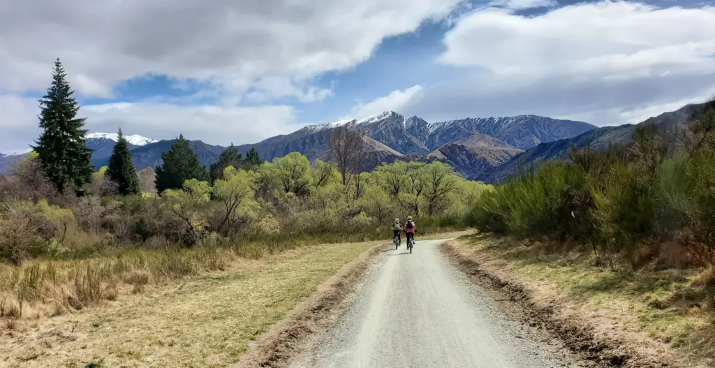
The Arrow River Trail is a beautiful short walk in Arrowtown that takes you along a short section of the towns picturesque river, and connects to other walking tracks heading into the hills! This track is mostly flat and very easy – perfect for families or for a beautiful bike ride!
Trail Description
The Arrow River Trail starts at the Butlers Green notice board and heads left to the footbridge over Bush Creek. From here, turn right, then follow the track around to the left until you see the Arrow Irrigation Pipeline. The track follows the pipeline most of the way and rises high above the Arrow River – giving you incredible views over the surrounding landscape! The trail is surrounded by beautiful wildflowers in summer, or vibrant orange and yellow foliage in Autumn – making it a beautiful walk no matter the season!
After walking for around 20 minutes, you will reach the picturesque Sawpit Gully Waterfall, where the stream flows down into the Arrow River. This is a perfect spot for a rest and to soak up the surroundings! After the falls, you will pass the turn off the the Sawpit Gully Trail, and arrive at the Norman Smith Footbridge – the end of the trail. From here, turn around and retrace your steps home.
Tip: Alternatively, you can continue along the more challenging Sawpit Gully Trail or the Macetown 4WD track if you want to make a full day of it!
Arrowtown Millennium Walk
- Trail Length: 3.25 kms
- Walking Time: 1 hour return
- Trail Difficulty: An easy stroll along the banks of the Arrow River
- Walking or Biking Trail
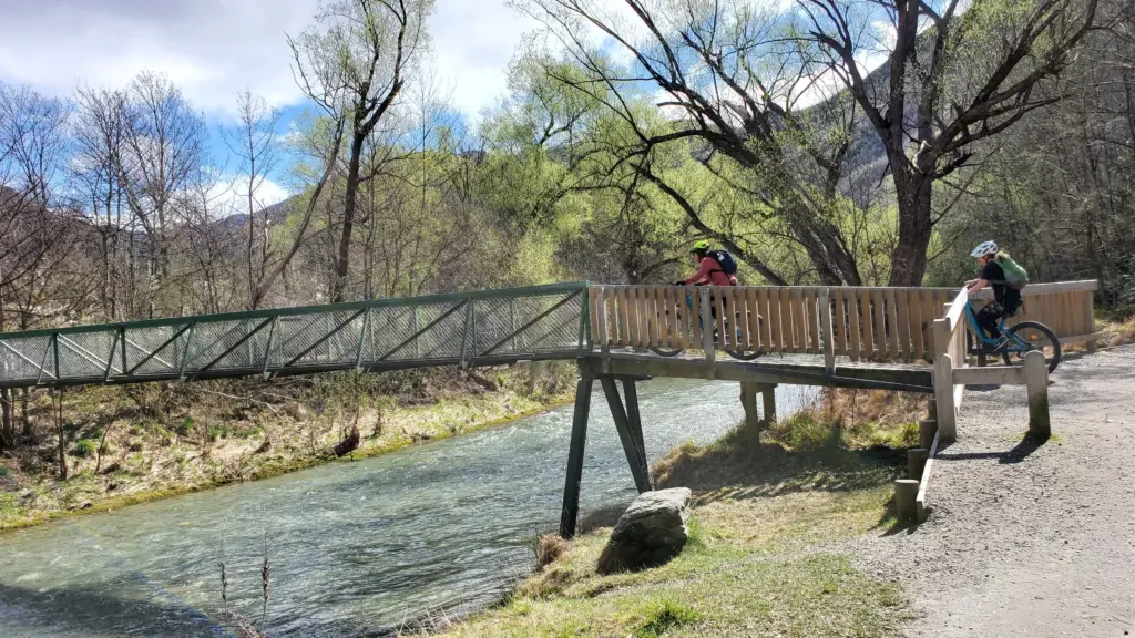
The Arrowtown Millennium Walkway is a beautiful loop walkway that follows the banks of the stunning Arrow River. This is one of the most popular walks in Arrowtown, and is a must during your visit! This is a great family walk or bike ride, as the trail is smooth and well-maintained.
Trail Description
The track begins at Ramshaw Lane, and follows the true right of the stunning, willow-lined river as it winds its way to Tobins Bridge. From here, you can continue to follow the river banks until the next bridge, where you can cross and head upstream back to Tobins Bridge and the junction with Tobins Track.
Trail Highlights
The Arrowtown Millennium Walkway was built in 1998, to mark 150 years since Europeans settled in Otago, and it takes you past some interesting historical landmarks along the way! At the beginning of the walk, you will pass ‘X marks the spot’ – where gold was first discovered in Arrowtown, sparking the Gold Rush! The trail also passes one of New Zealand’s first quartz mines, as well as a filming location for Lord of the Rings!
Tobins Track
- Trail Length: 4.9 km
- Walking Time: 1 hour return
- Trail Difficulty: Easy with a bit of uphill
This stunning short walk in Arrowtown offers some incredible views over the township and the incredible Wakatipu Basin!
Trail Description
Tobins Track begins at the bottom of Ford Street, from the car park at O’Callaghan Park. From here, the trail begins by crossing the serene Arrow River, and then following a short-but-steep walkway up into the hills. At the top there are a couple of bench seats, which are an awesome place to sit and soak up the incredible views over Arrowtown and the wider Wakatipu Basin before heading back down.
The Best Half-Day Walks in Arrowtown
Lake Hayes Walkway
- Trail Length: 8 km loop
- Walking Time: 2 – 3 hours
- Trail Difficulty: An easy walking track
- Walking or Biking Track
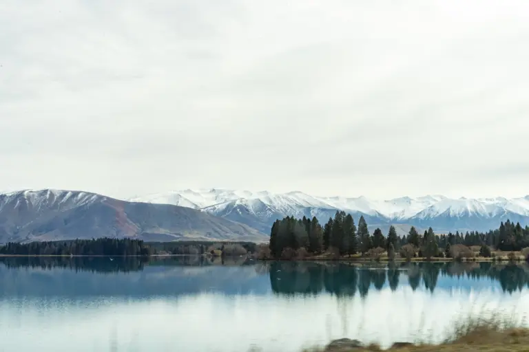
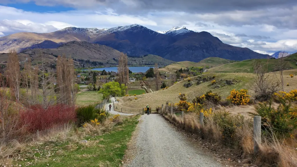
Not far from Arrowtown is the beautiful Lake Hayes Walkway! This is a popular walking and cycling trail that offers breathtaking views of Lake Hayes and the surrounding mountains, making it a favourite destination for both locals and tourists!
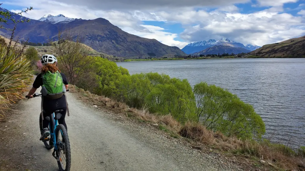
Trail Description
The Lake Hayes Walkway is a loop trail, following the shores of the stunning Lake Hayes. The track is around 8km long, and is well-maintained and relatively flat – making it perfect for a family walk or afternoon bike ride!
Trail Highlights
The highlight of this trail is the panoramic views over Lake Hayes, which is known for its mirror-like surface. On a calm day, you can see the incredible Remarkables mountain range reflecting back! This is also a haven for wildlife and birds, with the wetlands area being one of the few sites where you can see the rare Australasian Crested Grebe!
Sawpit Gully Trail
- Trail Length: 8km loop track
- Walking Time: 2-3 hour loop track
- Trail Difficulty: Medium difficulty
- Fitness Required: Medium – High fitness levels required
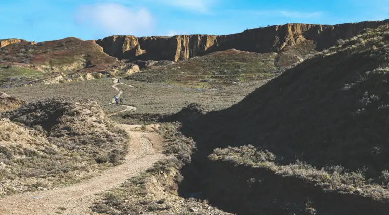
The Sawpit Gully Trail is an enjoyable half-day walk in Arrowtown, that travels mostly through open tussock landscape with incredible scenery and panoramic views over the surrounding mountains!
Trail Description
The walk begins at the Buckingham Street carpark, near the Chinese Settlement in Arrowtown. The beginning follows the easy Arrow River Trail, as it winds along the river bank, passing the beautiful Sawpit Gully Waterfall along the way!
Tip: The best way to walk this loop track is counter-clockwise (along the Arrow River Trail first), as it means your uphill climb is easier!
Just after the waterfall, the trail branches to the left, and heads up into the magnificent Sawpit Gully! The trail gets much steeper as it climbs into the gully, as it follows parts of a water race and past piles of historic stone gold mining tailings! The climb continues into open, tussock-covered landscape as the trail crosses the saddle between German Hill and Brow Peak – an awesome spot to rest and soak up the spectacular views over Lake Hayes and the Remarkables!
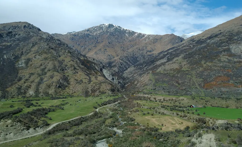
From the saddle, the track heads downhill along the Big Hill Trail towards Arrowtown, giving you magnificent views over the Wakatipu Basin.
The Best Full-Day Hiking Trails in Arrowtown
Big Hill Trail
- Trail Length: 15.5 km return
- Walking Time: 5 – 7 hours
- Trail Difficulty: A moderately-challenging tramping trail, with some steep sections
If you are looking for a challenging day-walk in Arrowtown that rewards you will incredible views, then check out the Big Hill Trail. This track climbs through stunning native forests and over a golden tussock-covered saddle until you reach the summit of Big Hill!
Trail Description
The trail begins at the Buckingham Street Car Park, and follows an old bridle trail that used to be the main route into Macetown in the 1880’s! From Bush Creek, the trail dives into the forest, and climbs steadily until you reach Eichardt’s Flat. Here, the trail flattens out slightly, and gives you a chance to take in the breath-taking views over the Wakatipu Basin and Lake Hayes!
From the saddle, the trail splits, with the right branch heading to connect with the Sawpit Gully Trail. Continue straight, and the trail winds its way through dry tussock lands and a patch of mountain beech forest, with one last climb to the summit! The panoramic views over the surrounding mountains and dramatic gullys are definitely worth the effort!
Related Posts: