A Travel Guide to Northland, New Zealand!
Last Updated: 17th July, 2023
Welcome to Northland, New Zealand’s northernmost region! This is known as the ‘Winterless North’, and is known for its beautiful long sunny days and golden beaches. I had been looking forward to visiting Northland, and at the end of our two years travelling New Zealand, we finally got the chance to head to the top of the North Island. It was everything I hoped for, and more!
The region is located north of Auckland, and stretches from Mangawhai Heads in the south all the way to Cape Reinga in the north. It is home to some of the most stunning scenery in New Zealand, from the majestic Bay of Islands to the rugged Cape Reinga coastline, and is filled with ancient green forests and unique small towns drenched in history. A bonus: its warm climate means that travelling here feels like a summer holiday no matter what the season!
What is the best time to visit Northland?
If you’re looking for warm weather and plenty of sunshine, the summer months of December to February are the best time to visit. During this time, temperatures can reach highs of around 25-30°C and the days are long and sunny. This is a great time to enjoy outdoor activities such as swimming, hiking, and exploring the region’s beautiful beaches. However, this is also the peak tourist time in Northland, and so you could find yourself having to share your adventures with a bunch of other people!
If you want to escape the crowds a bit, the shoulder months of September-November, and March-May, can also be a good time to visit Northland! The temperature is still quite warm, with days averaging between 15-20°C, and you can enjoy the region’s attractions without competing with other tourists. This is also a fantastic time to go, as it is a lot cheaper than travelling in summer, and often you don’t have to book tours in advance. We travelled to Northland in November, and it was perfect! We had lovely long sunny days, where I could go for a hike or relax on the beach, and we were often one of the only people at a campground! This made it feel particularly special to us.
How to get to Northland!
Northland is one of the more remote regions of New Zealand, and so there are less options for public transport to get around. The best way to view Northland is by car, as it gives you the freedom to adventure out of the towns and into the wild, as well as to stop off at one of the many beautiful beaches or scenic spots along the way!
There are several ways to get to Northland, depending on where you are coming from and your preferred mode of transportation. The closest big city is Auckland, and you will most likely travel through here on your way through to Northland.
Flying to Northland:
If you are traveling from outside of New Zealand, you will most likely arrive at Auckland International Airport. From there, you can take a domestic flight to Whangarei Airport, which is located in the heart of Northland. Flights from Auckland to Whangarei take around 45 minutes.
Driving to Northland:
Northland is easily accessible by car and is approximately a 2-3 hour drive from Auckland. From Auckland, you can take State Highway 1 north to Whangarei and then continue on into Northland!
Northland by Bus:
Several bus companies operate services between Auckland and Northland, with regular departures throughout the day. These services typically stop at major towns and cities along the way, including Whangarei and Paihia. The InterCity bus service runs daily from Auckland to the tourist town of Paihia, and is an awesome way to get into the heart of Northland! See the timetable or book a bus here.
TOP THINGS TO DO IN NORTHLAND
Northland offers an awesome variety of things to do while you are visiting the region. Whether you are keen to get onto the water or get lost in the woods, relax on the beach, soak up some culture, or just have a mooch around new towns, there is something for everyone! In this list I have mentioned some of our favourite things to do (and must-sees) when we visited Northland, however, I found the longer we stayed, the longer we wanted to!
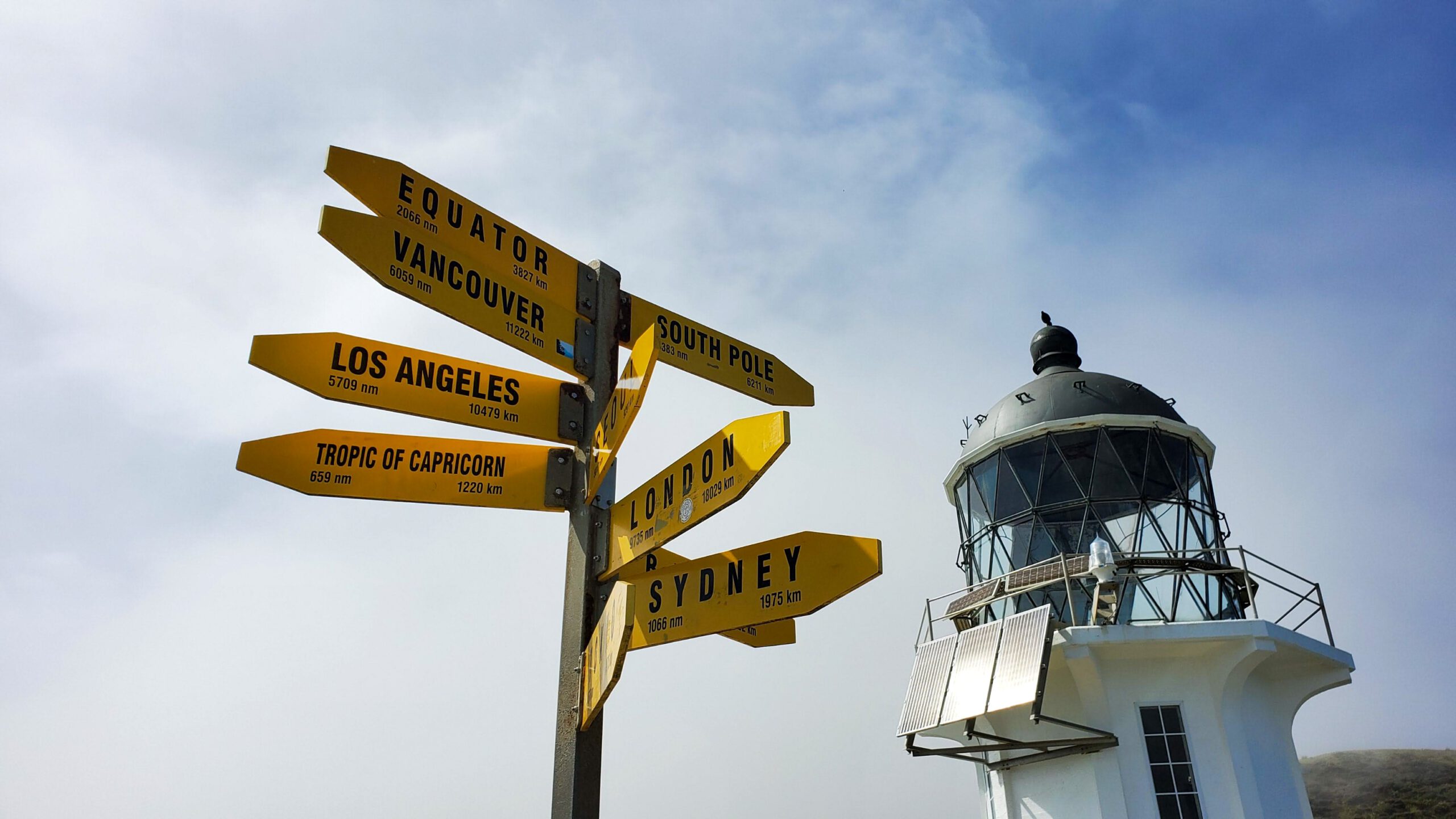
Cape Reinga
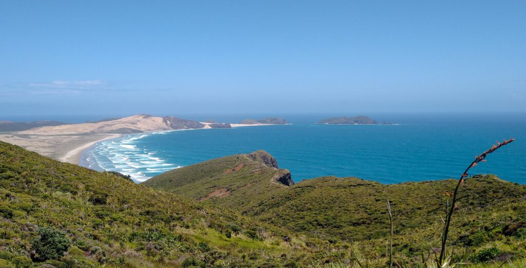
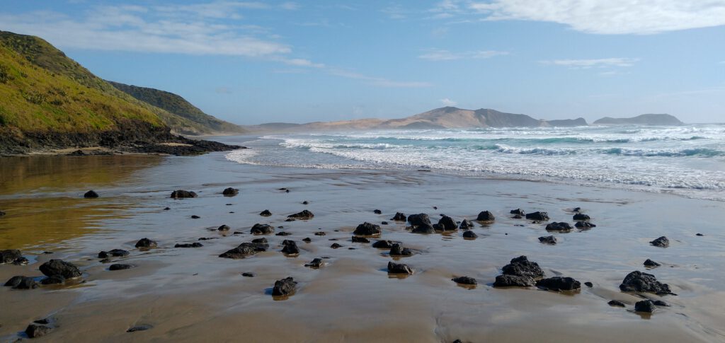
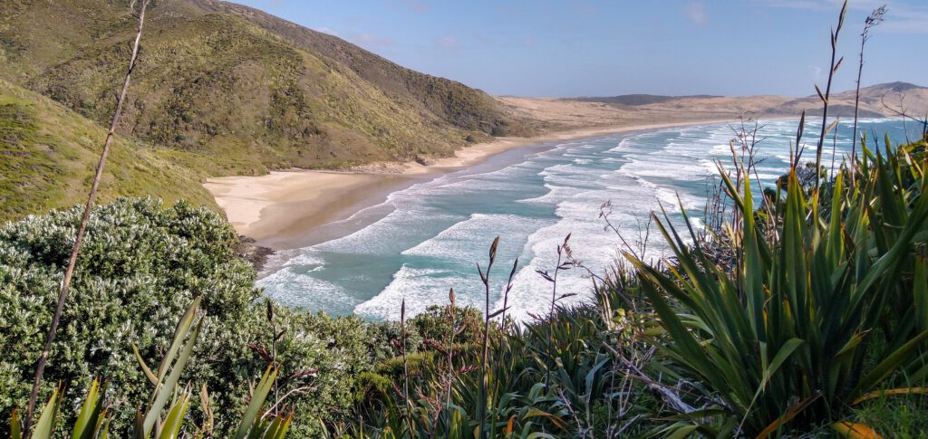
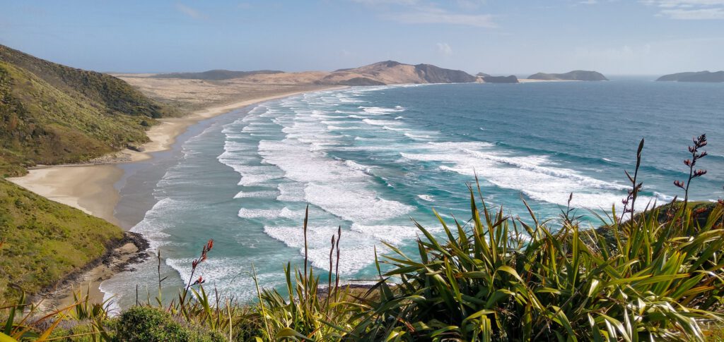
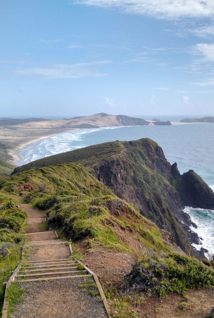
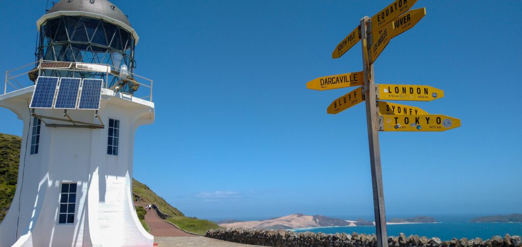
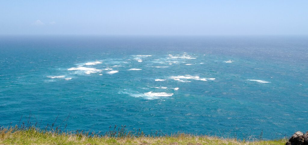
Cape Reinga is the northernmost point of New Zealand, and is an awesome place to visit while in Northland! It has breathtaking views from the top of the headland over the beautiful Te Werahi Beach and Cape Maria Van Diemen to the south, and you can witness the power of two oceans colliding where the Tasman Sea and the Pacific Ocean meet in a spectacular swirl of currents.
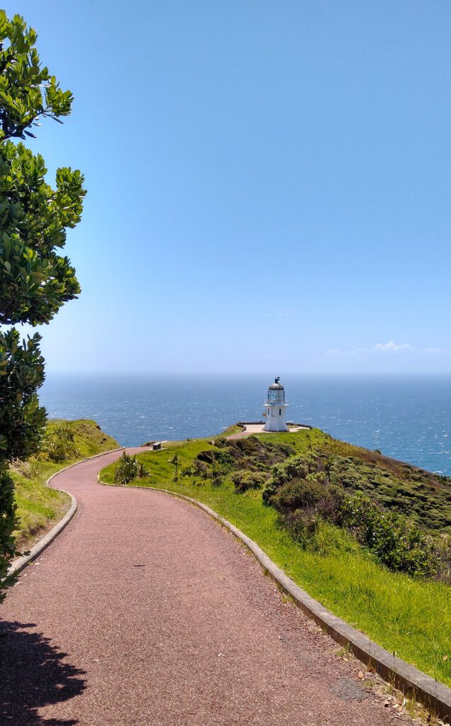
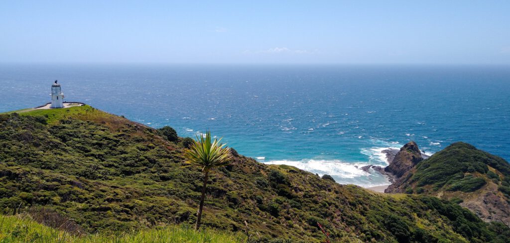
Cape Reinga Lighthouse Walk
The walk to the lighthouse is one of the biggest draws to the area, and worth every minute of the long drive up to the cape. The walk begins at the carpark, and winds its way along the stunning coastline, with incredible views over the Tasman Sea and Pacific Ocean meeting. The walk takes you through a variety of landscapes, including sandy dunes, grassy hills, and rocky outcrops. As you approach the lighthouse, you will be rewarded with even more spectacular views of the surrounding area. The lighthouse itself is perched on a rocky outcrop and offers panoramic views of the ocean and the rugged coastline.
The walk is relatively easy to do, with a wide, well-maintained path that is well suited for all fitness levels, as well as those with a wheelchair or stroller. It will take around 15-20 minutes to reach the lighthouse, with lots of stops on the way to take in the magnificent scenery!
Māori Culture and History
Cape Reinga, or Te Rerenga Wairua as it is known in Maori, is an incredibly significant site in Maori culture. According to Maori legend, Cape Reinga is the place where the spirits of the deceased depart on their final journey to the afterlife.
In Maori mythology, it is believed that the spirits of the dead travel up the coast to Cape Reinga and then make their way down to the nearby rocky islet of Te Kurī-a-Pāoa. At the northernmost tip of the Cape is a gnarled pohutukawa tree, believed to be over 800 years old. According to Maori oral history, the spirits of deceased Maori leap from this tree into the ocean to return to their ancestral homeland of Hawaiki.
When visiting Cape Reinga, you can feel how special this area is. It’s important to be respectful during your visit, so make sure you stick to the track provided, and leave your dogs at home.
Getting to Cape Reinga:
Cape Reinga is located at the top of State Highway 1, and although it’s a big ol drive to get there, I promise you it’s worth it! The closest major town to the cape is Kaitaia, which is about 1.5 hours drive away. There are also some smaller settlements along the way, such as Pukenui, Houhora, and Te Kao, if you want a place to stop and rest.
The drive is nice and easy, and offers some incredible views of the peninsula, along with a lot of views of farmland. Bonus: the whole road is now completely sealed, so no need to worry about getting caught on a classic New Zealand gravel road!
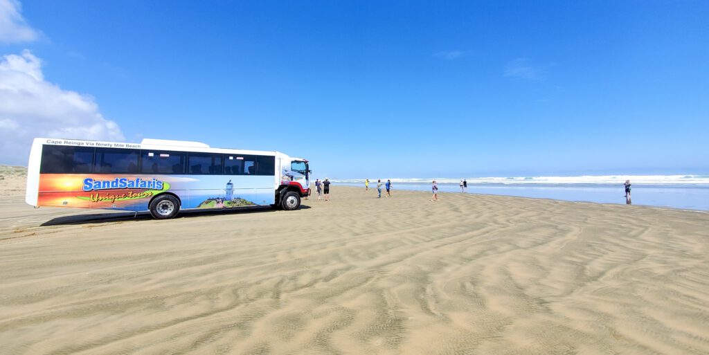
If you would prefer not to drive, there are some awesome tours that will take you from the town of Kaitaia all the way to the Cape Reinga lighthouse. These include the added excitement of driving up 90-Mile Beach, and possibly having a slide down the Te Paki Sand Dunes along the way!
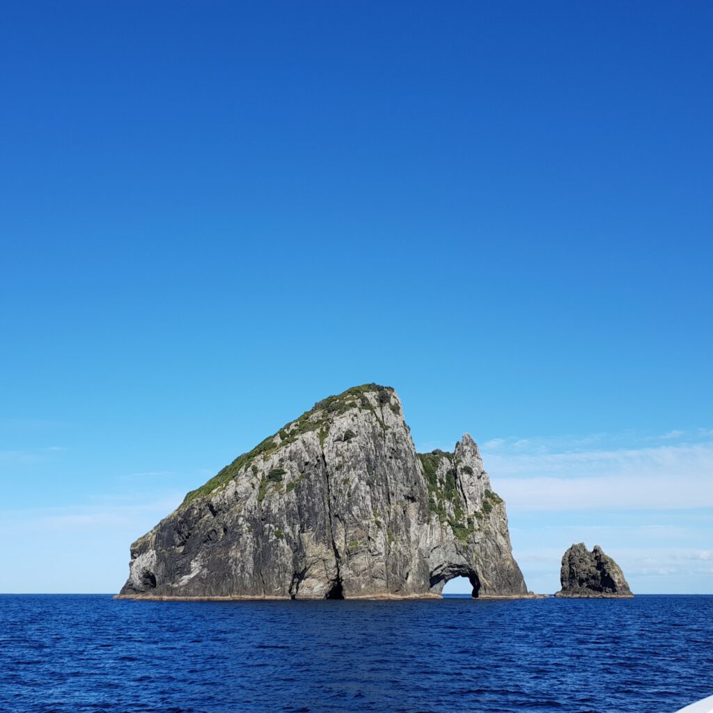
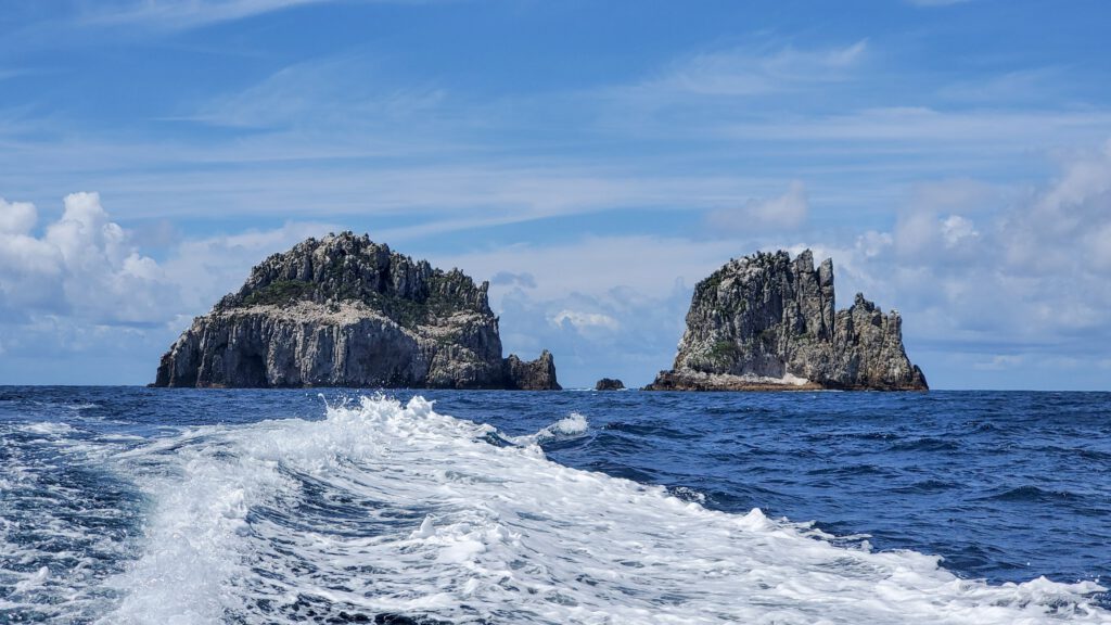
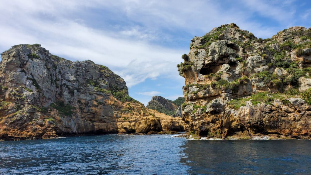
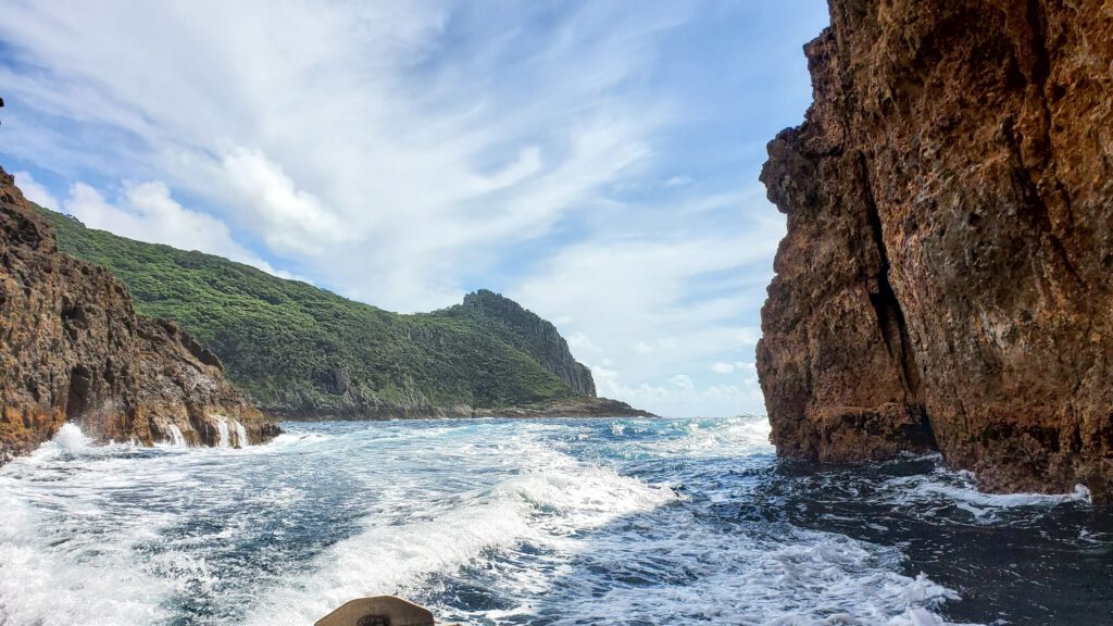
Poor Knights Islands/ Tawhiti Rahi
If you love to snorkel or dive, your Northland bucket list wouldn’t be complete without a trip to the Poor Knights Islands! The Poor Knights is made up of two large islands and a group of smaller islands, and boasts of being one of the best diving and snorkeling destinations in the world!
These stunning islands are a protected marine reserve, and are absolutely packed with incredible underwater wildlife. The water around the Poor Knights is crystal clear and the warm, sub-tropical currants provide a rich, varied and abundant sea life. Divers and snorkelers can explore through thick kelp forest, over sponge gardens and coral reefs, and admire the hundreds of species of fish, stingrays, and eels that call this reserve home. As it has been a marine reserve for over 20 years, the fish have no fear of people and will happily interact with you as you dive beneath the surface!
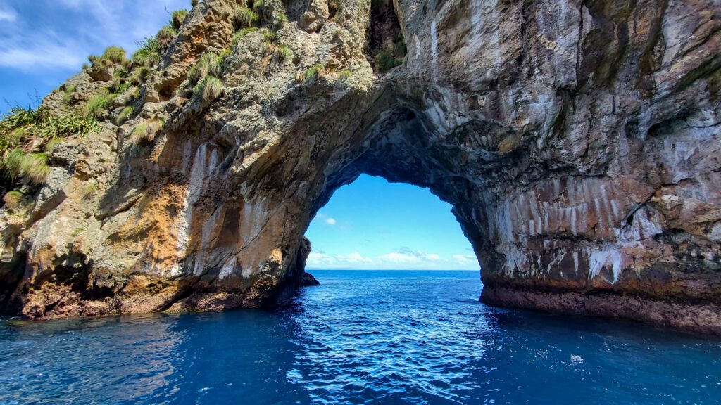
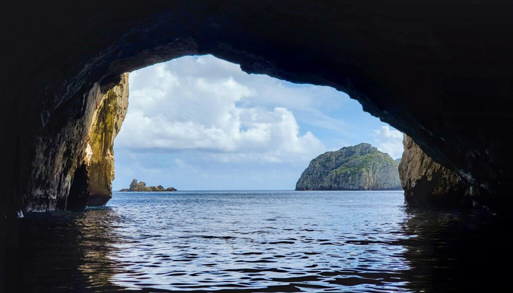
The Poor Knights also contains some incredible underwater geology, and is home to one of the largest sea caves in the world. The Rikoriko Cave was formed about 15 million years ago by a gas bubble from a volcanic eruption, and is large enough to fit 4 boats!
As well as the spectacular underwater life, the Poor Knights is a nature reserve, and is home to a huge variety of native birds, insects, and the tuatara (New Zealand’s native lizard, and one of the world’s oldest living species). Many of these animals are rare or extinct on the mainland, and so this environment is incredibly special to witness. However, although you are welcome to swim and enjoy the waters around the Poor Knights Islands, you are not allowed to land.
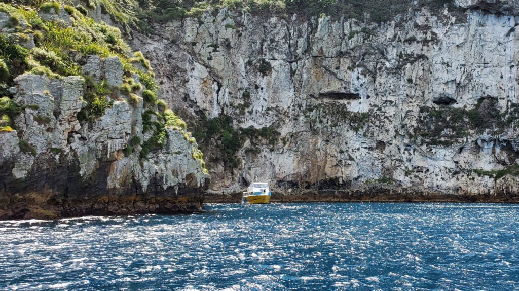
How to get to the Poor Knights Islands?
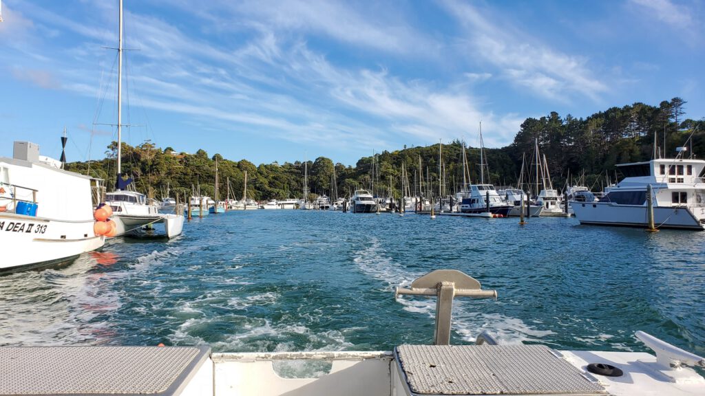
The Poor Knights Islands are located off the east coast of Tutukākā, a small town around 30 kilometers north of Whangārei.
The best way to enjoy these incredible islands is to book a dive or snorkeling adventure from one of the many tour operators located in Tutukākā, as the islands are only accessible by boat. A tour that I would highly recommend for non-divers is a Perfect Day, which is run by Dive Tutukākā. We wanted to find an adventure that would allow us to see the best of the Poor Knights Island, and this checked all the boxes! This is an incredible experience, with spectacular sight-seeing, swimming and snorkeling opportunities, a visit to the Rikoriko cave and various arches, and a lunch provided. How good!
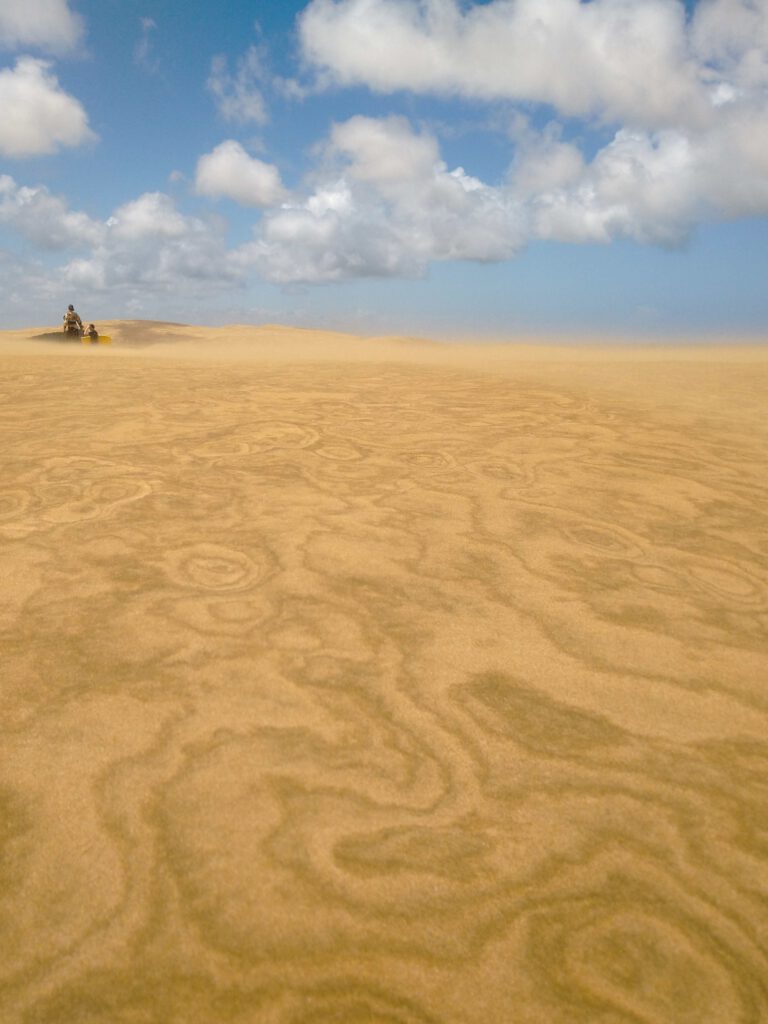
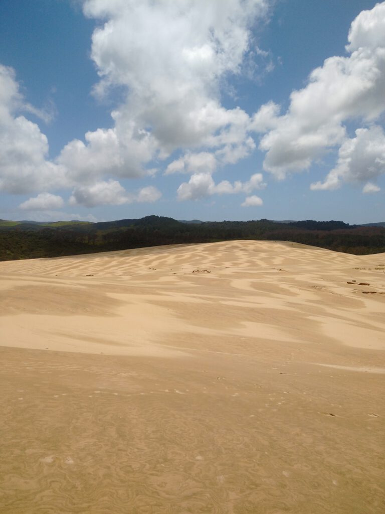
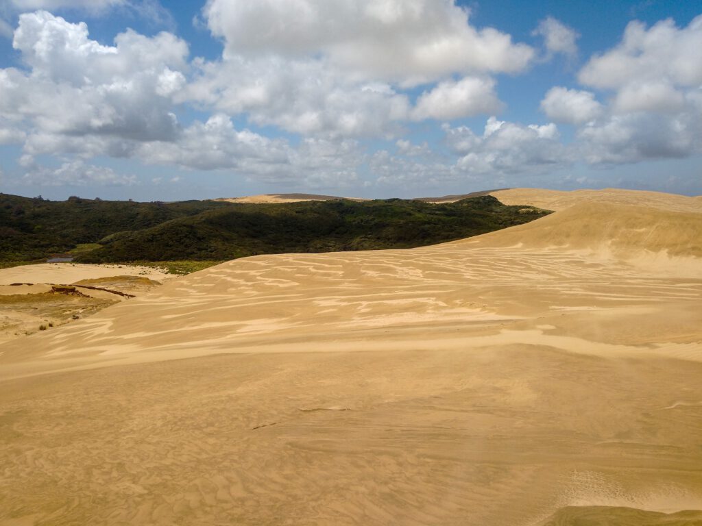
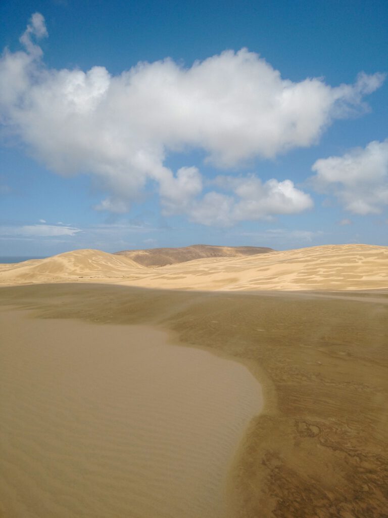
Te Paki Sand Dunes
An adrenaline-boosting way to break up your drive to the iconic Cape Reinga Lighthouse is to visit the seriously steep Te Paki Sand Dunes, and have a go at some exhilarating sandboarding! These incredible sand-dunes are found along 90-Mile Beach, and some of them are over 150 meters tall. BYO a boogie board, or hire one in the car park for $15/day. There are also a few places along the main highway that offer board rentals, so keep your eyes peeled, and make sure you have some cash.
From the car park, you cross over a small stream and start the steep climb up the sand dunes. It truly feels as if you have been dropped onto Mars! With rolling hills of fine sand stretching as far as the eye can see, it is definitely an incredible sight. Be prepared to get absolutely covered in sand, and I would recommend a pair of sunglasses to help protect your eyes if the wind picks up.
How to get to Te Paki Sand Dunes:
Starting at Kaitaia, it should take you around 1.5 hours to reach the incredible Te Paki Sand Dunes. Follow state Highway 1 along for 94kms, and you will see a well-signposted turn to the left, which will take you to the sand dunes car park. This is a well-maintained and wide gravel road, however take it slow and steady, as it can be quite busy during the summer months, and you don’t want a stone through your window! There is a good amount of parking available, as well as toilets and a few picnic benches, so it is a lovely spot to stop off and enjoy the view!
There are also many tour companies that travel from Kaitaia towards Cape Reinga, and they often include a stop at the sand dunes.
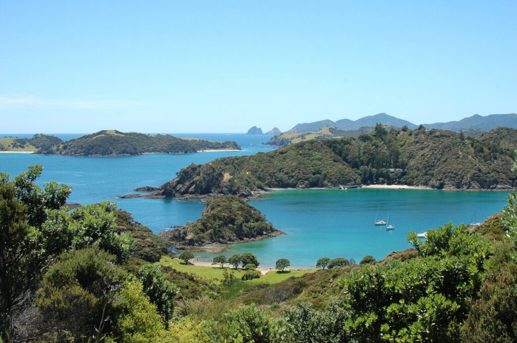
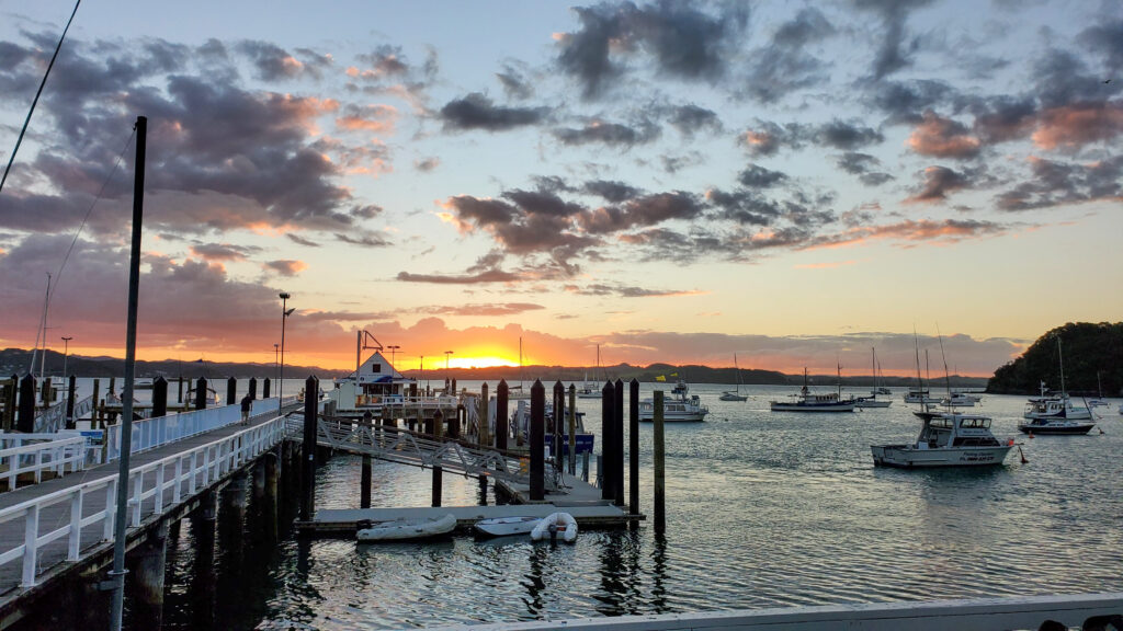
Bay of Islands
The Bay of Islands is a stunning area in the Northland region. It is comprised of 144 islands between Cape Brett and the Purerua Peninsula, and is home to crystal clear waters, white sand beaches, and lush vegetation. The region is popular for boating, sailing, fishing, and kayaking, and visitors can also enjoy swimming with dolphins, snorkeling, and diving in the pristine waters.
While here, you can also visit the boutique towns of Paihai, Russel, and Kerikeri, each with its own unique charm and attractions. Paihai is the main tourist town of the Bay of Islands, and is a great place to base yourself while exploring the surrounding area. There is a wharf in the centre of Paihai beach, which offers ferry services to the surrounding towns of Russel and Waitangi, as well as being a central hub for tour operators in the area.
If you are interested in reading my travel guide to the Bay of Islands, see my post here!
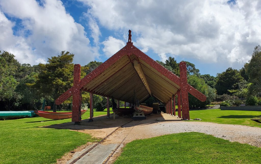
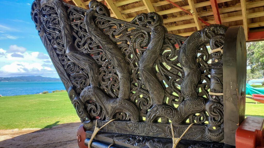
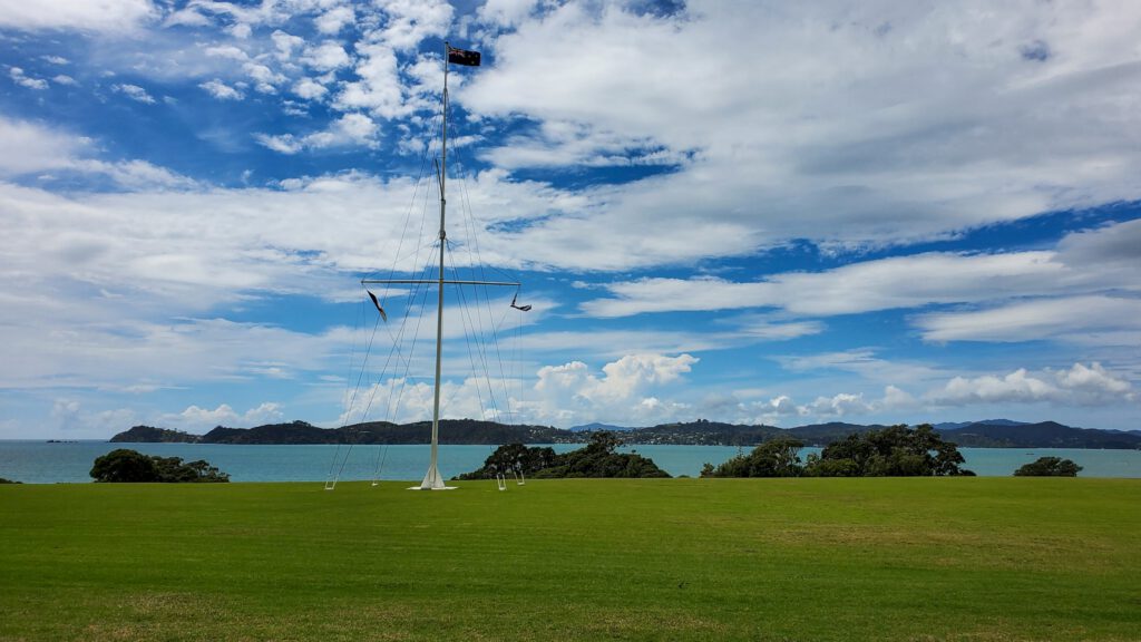
Waitangi Treaty Grounds
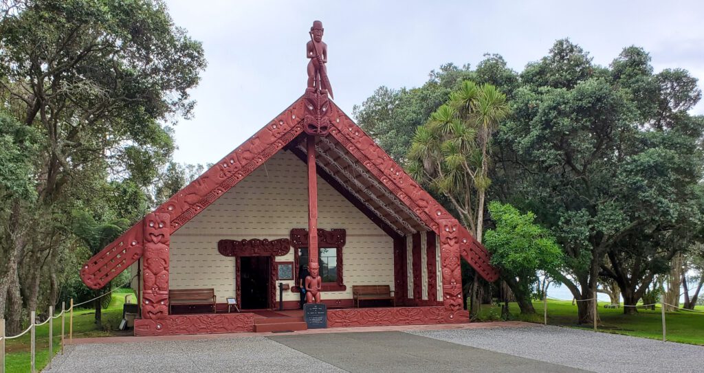
The Waitangi Treaty Grounds is a must-visit attraction in Northland, New Zealand. It is steeped in history, and is where the Treaty of Waitangi was signed in 1840, establishing a relationship between the British Crown and the Māori people. Now, the grounds offer a beautiful and informative cultural experience that gives you a glimpse into the region’s past.
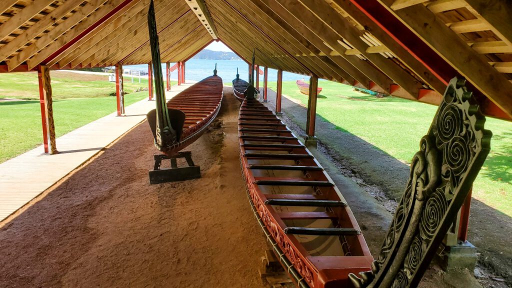
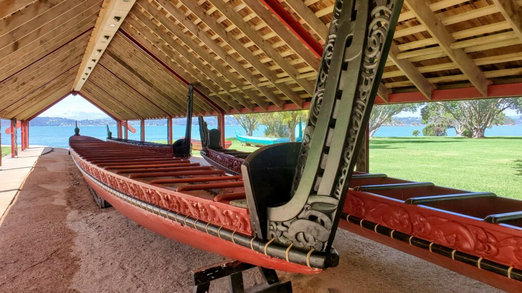
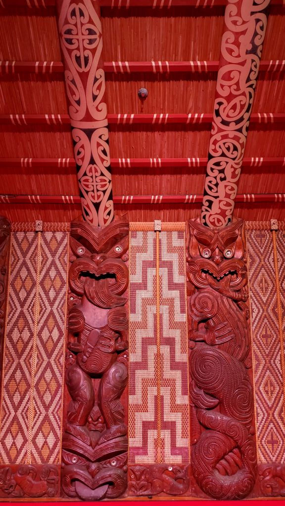
When visiting the Waitangi Treaty Grounds, you can take a guided tour or explore the grounds on your own. I would definitely recommend the tour, as the incredible tour-guides provide a wealth of information about the history of the site and the Treaty of Waitangi. The tour takes you through the Treaty House, which is the oldest building in New Zealand (!!), and the place where the treaty was signed. There is also a beautiful Marae (Māori meeting grounds), a traditional Māori waka (carved canoe), and a visitors centre with interactive displays.
One of the highlights of a visit to the grounds are the powerful Māori cultural performances. You can see a Māori cultural show, including traditional song and dance, as well as demonstrations of Māori crafts and games.
Around the Waitangi Treaty Grounds there are beautiful gardens and lush native forest, with small walking tracks and a stunning view of the Bay of Islands. It makes for an awesome and immersive day out, and certainly needs to be on your Northland bucket list!
Getting to the Waitangi Treaty Grounds:
The Waitangi Treaty Grounds are located in the small coastal town of Waitangi, which is around 10-minutes drive north from the touristy hot-spot of Paihia. If you’re driving, just follow State Highway 11 north from the centre of the town to Waitangi. There is plenty of parking available.
If you don’t have a car, it is a stunning 30 minute walk along the beach and across the Waitangi River to reach your destination, with views of the Bay of Islands and the crystal clear water.
Or else if you would prefer to travel by water, there is a small ferry service that travels from Paihai wharf to Waitangi! The ferry departs regularly, and takes about 10-minutes to reach the Treaty Grounds, complete with incredible views!
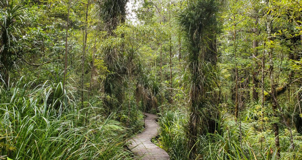
Waipoua Forest
Northland is known for its incredible native kauri forests, a green world filled with ancient, towering trees and colourful ferns. The largest of these forests is the Waipoua Forest, found north of Dargaville on Northlands west coast.
This forest is the home of the magnificent Tāne Mahuta, an ancient kauri tree estimated to be over 2,000 years old, and known as ‘God of the Forest’. When you see him, you can understand why! At over 45 metres tall and 4.4 metres in diameter (and still growing!), it is an incredible sight to see. In addition to Tāne Mahuta, there are several other notable trees in the forest, including Te Matua Ngahere, which is the oldest known kauri tree in New Zealand, and Yakas, which is one of the largest kauri trees in the forest.
The Waipoua Forest is not only important for its ecological significance but also for its cultural significance to the local Māori people. The forest is considered a sacred place, and there are several walking tracks that visitors can take to learn about the Māori history and mythology associated with the area.

Tāne Mahuta Walk
This easy walk begins at the well-signposted car park off the SH12, around 65km north of Dargaville. The walk takes you into the cooling shade of the forest canopy, where you will come face-to-face with Tāne Mahuta. The path consists of a boardwalk, and so is buggy and wheelchair accessible, and takes about 10 minutes return.
Te Matua Ngahere Walk
This walk takes you a little further into the Waipoua Forest, to the base of the ‘Te Matua Ngahere’ or the Father of the Forest – the second largest living kauri tree in the forest. There is a wonderful viewing platform where you can see the tree in all its glory, without damaging the fragile root system. The beginning of this walk begins in a car park off the SH12, and is located around 3 minutes from the Tāne Mahuta Walk. It takes about 20 minutes one way.
Before you go: The Kauri is part of New Zealand’s heritage. However, kauri dieback disease is threatening their extinction. When exploring this magnificent forest, please respect displayed kauri protection guidelines, and stick to the boardwalk track. Find out more about kauri dieback disease and how you can prevent its spread here.
If you would like to experience the magic of the forest at twiliight, and learn about the kauri trees and their strong connection to the Māori culture, you can take a tour with Footprints Waipoua. A local Māori guide will take you through the forest, telling stories and legends of the forest, and visit these ancient kauri trees. This is a truly special way to visit Waipoua Forest.
Where to find the Tāne Mahuta Walk:
The Waipoua Forest is found on the western coast of Northland, and is around an hour and a half drive from the town of Paihia. This road is long and windy, but has incredible views of the surrounding forests and countryside, and is definitely worth the drive!
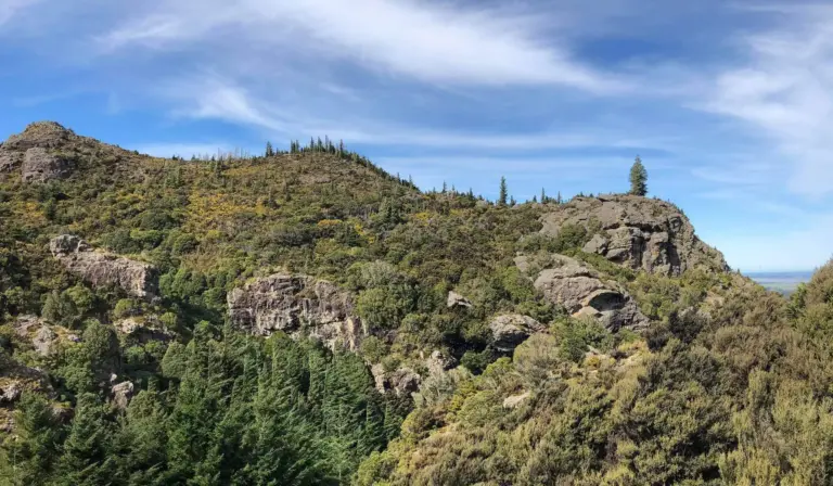
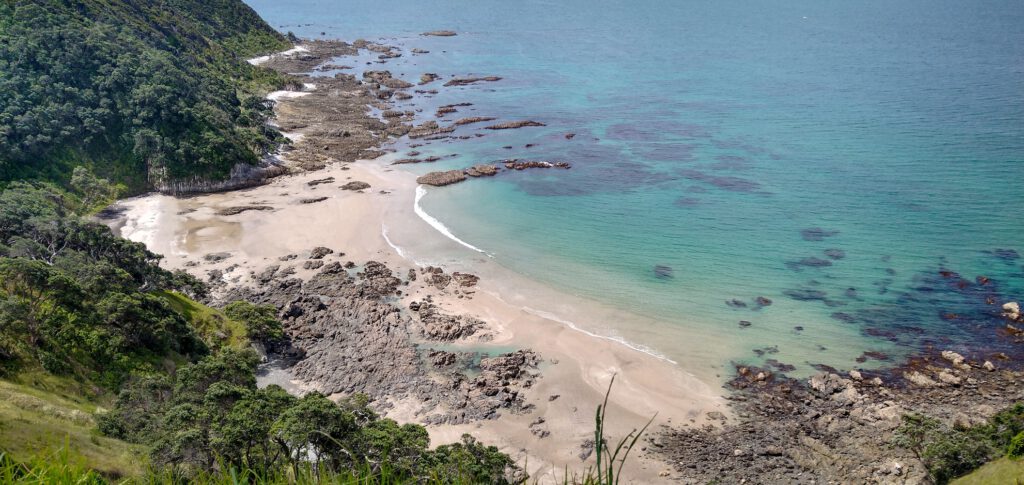
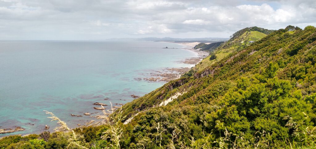
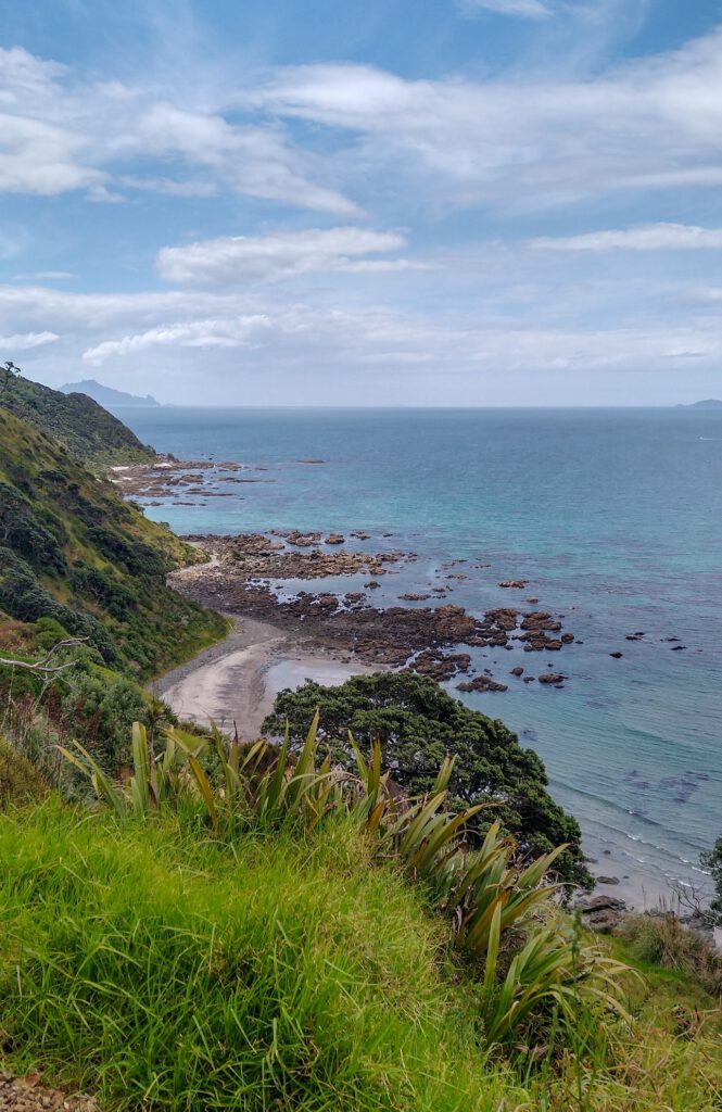
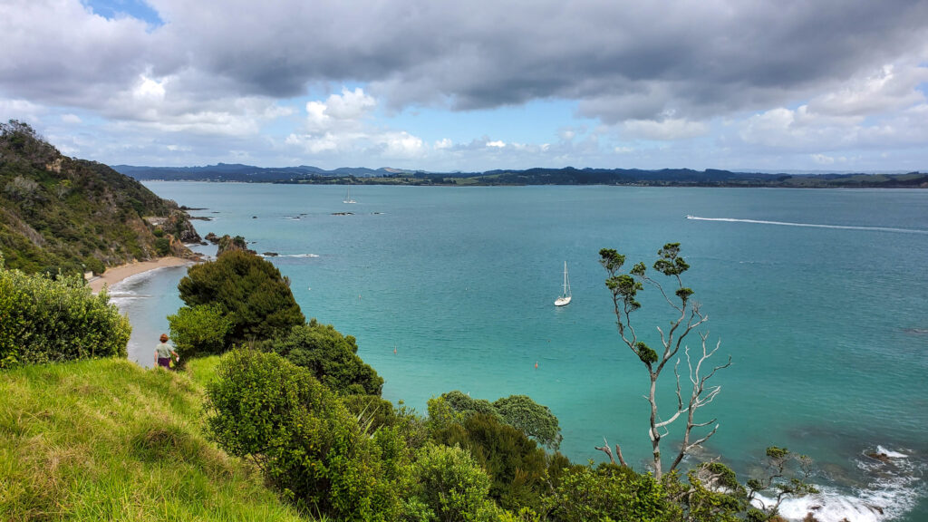
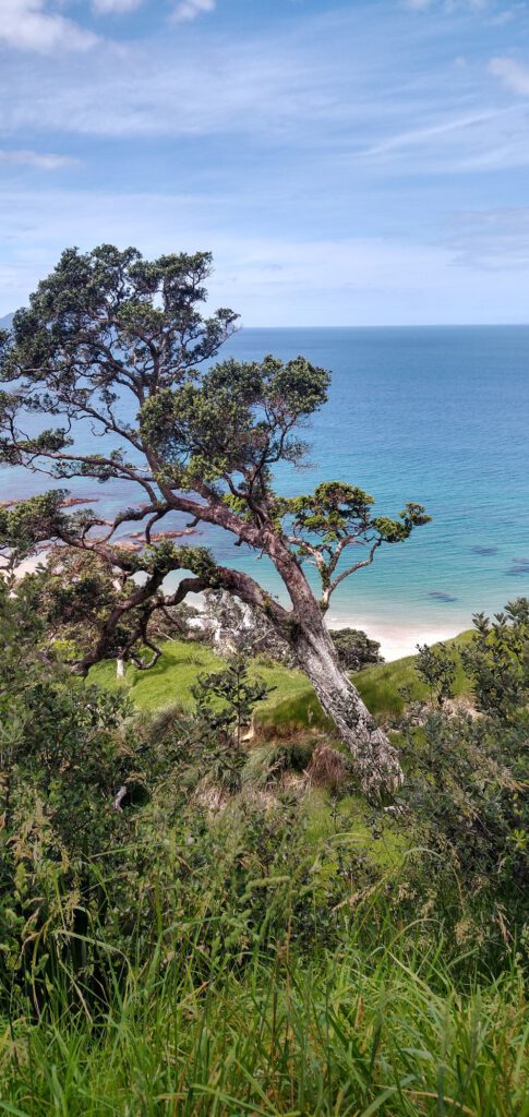
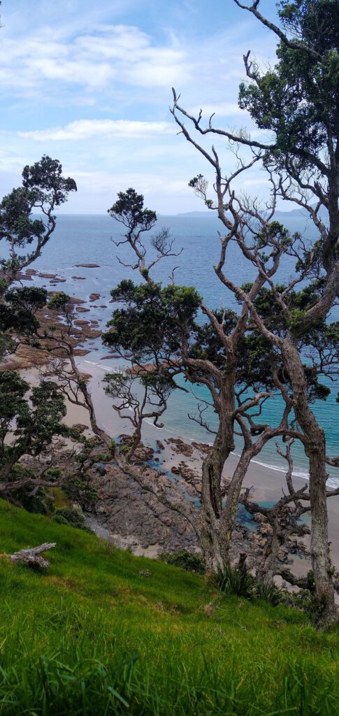
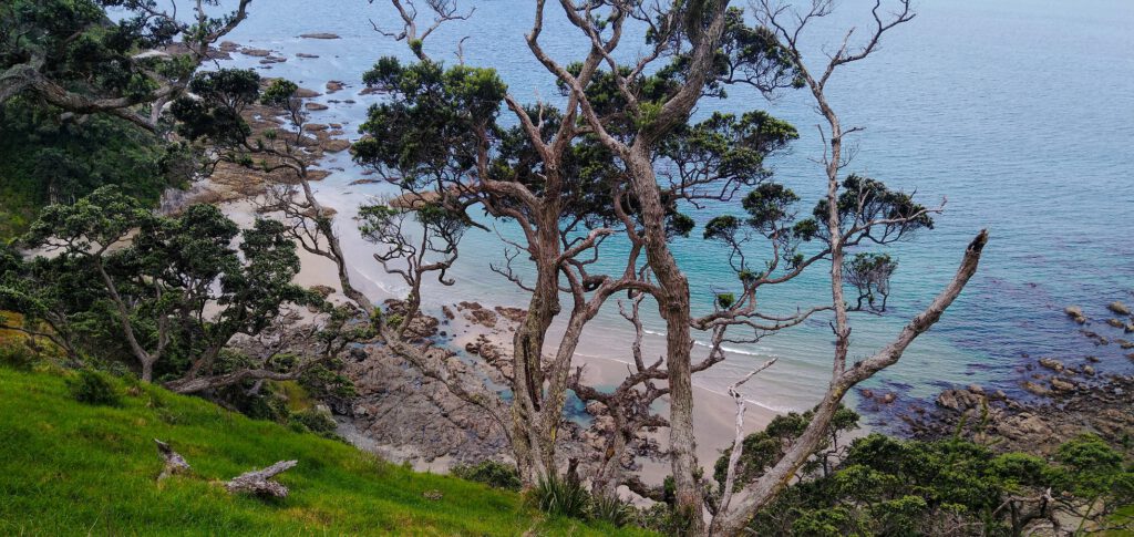
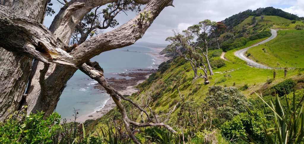
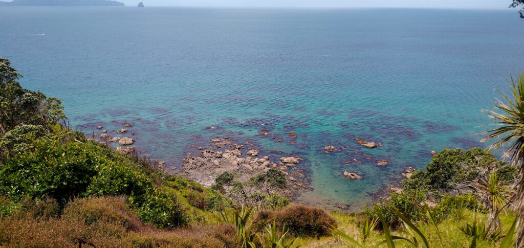
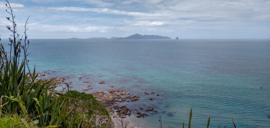
Mangawhai Cliff Walk
This walkway has been on my bucket list for years, ever since my mum and dad travelled Northland and could not stop talking about it! Finally, after two years of travelling New Zealand, Timo and I finally made it to Northland, and I got to experience the magic of the Mangawhai Cliff Walk.
Firstly, the walk was just amazing, and exactly what I hoped for. The walk begins on Mangawhai beach, where you walk along beautiful golden sand and enjoy the crystal clear water. The walk then viers up a steep slope until you are at the top of the cliffs, where you are treated to the most spectacular views of clear blue water, fine sandy beaches and white cliffs. The walk itself travels through beautiful native bush, with totara, kahikatea, and pohutukawa lining the track.
Once you reach the end of the loop, you can either head back along the track the way you came, or, if it’s low-tide, head down to the beach and walk back along the sand, stopping to explore rock pools or have a swim along the way!
The walk is of moderate difficulty, as it has a lot of steps and some rough terrain, however as long as you have good walking shoes you should be fine. It takes around 2-3 hours return.
FAQs
Thank you for reading my post on travelling to the stunning region of Northland! I hope you enjoyed it! 🙂
If you are looking for good accommodation options in Northland, check out my post on the Top Campgrounds in Northland!